We were up early yet again this morning, doing all the last minute get ready stuff for today’s big trip inland. We had a large, eclectic breakfast made up of the odds and ends that were still left in the refrigerator when we shut it off.
At 0830, Tim arrived. We showed him how to run the generator and what the normal water level is in the bilge. He took us to shore. Our car was supposed to be delivered to us at Land and Sea at 0900. At 0940, the car finally arrived and by 1000 the paperwork was done and we were on the road. Our rental car is a little Suzuki Alto, powered by what we are sure is two hamsters on a wheel under the hood. We have our doubts it can make it up Costa Rica’s mountainous landscape.
We checked at two different places for maps, and neither had one. Sigh. We had to work off the maps in Lonely Planet, which are small and only have details for selected areas. Today’s plan was to drive to Heredia, just north of the capital city, San Jose. Judging from the map, we had estimated it would be a 4 hour drive. Katie and Tim told it would be closer to 6. It actually took 8.
To get out of Golfito, you can take an unpaved road over the mountains, or you can take a nicely paved road south to the end of the mountain range, then head inland and back north. We opted for the nice road, despite the fact that it is more distance. It is hard to tell for sure, but we think it was an extra 60 kilometers to go around. But, we had our doubts the car could take an unpaved, hilly road.
Golfito is much, much longer than we had realized. Beyond what we thought was the edge of town is a string of residences on big lots, with patches of undeveloped land here and there. The house range from small shacks to giant American style mansions, and we saw just about everything in between. The biggest percentage of homes, though, are simple one story concrete bungalows. We were pleased to find that the road was excellent.
The mountains actually flatten out fairly quickly, going from giant and insurmountable pillars to gentle plains in a surprisingly short space. The road inland came shortly after the mountains vanished and took us to the Pan American highway, a two lane road which runs all the way from Panama to Nicaragua. We turned north on the highway.
As we drove along, we noticed it was mostly farmland, with a few residences and some patches of undeveloped land. They seem to grow a lot of pineapple. We also saw some coffee, sugar cane and banana (or maybe plantain) plantations. There were a lot, and we mean a lot of fires on the various farms. We know that farmers sometimes burn the land before planting crops, so it must be the burning time of year.
As we progressed north, we noticed we were also slowly gaining in altitude, as well. The foliage in the undeveloped patches of land was definitely changing. It was becoming less jungle like and more forest like, less hot, humid and moist and noticeably cooler and drier. The whole feel of the area was completely different than Golfito, and we hadn’t gone very far yet. The road was great well kept, and mostly straight with some gentle curves here and there. We were flying along and thought we would make it in less than our estimated 6 hours.
We came to a small town called Palmar Norte. It was lunch time and we decided to stop here since we weren’t sure when we would get to another town. We drove around a little bit, checking out our food choices. It looks kind of like a lower middle class, blue collar neighborhood in America. An outdoor restaurant with a covered patio, very brightly colored décor, and really interesting statues caught our eye.
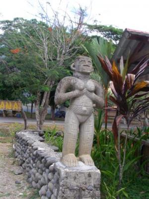
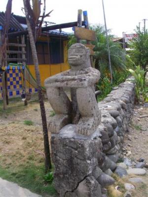
Christi was feeling adventurous and ordered something she had never heard of, called an emparedado. She was most disappointed when a simple sandwich came out. We thought the Spanish word for sandwich was torta. Eric was also adventurous and ordered mixed fajitas. The fajitas weren’t Mexican style. Instead, the pile of mixed meat had finely chopped tomato, onion, cucumber and cilantro mixed in and was served on a bed of tortilla chips and topped with a big dollop of sour cream.
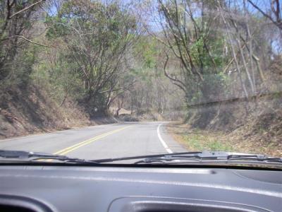
Once we got back on the road, the landscape really changed, looking like a dry mountain forest with no resemblance to the tropical jungle we had just left.
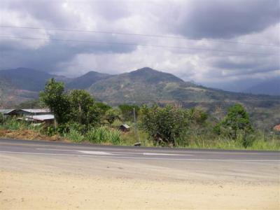
The road began to parallel a river, which was incredibly picturesque. The scenery was what you imagine Colorado to look like more than what you would expect Costa Rica to look like. We followed the river for a long time. We could visibly see the change in altitude as the river gradually went from being right next to us on the ground to far, far below us. We were still making great time. Here is a shot of the general scenery of the area.
Then we came to Santa Isabella, which is a fairly large, non-aesthetically pleasing city. Just past Santa Isabella, the scenery changed once again. Suddenly, the road became steep and seriously winding, always moving farther up and up with no dips down. There was a visible line where the foliage suddenly changed the plants were bigger, greener and more densely packed, and didn’t seem as dry. And about one second after noticing how much moister it was, it started to rain. And about one minute after it started to rain, we rounded a hairpin corner to see a huge truck overturned. It had slid off the middle of the road and was resting up against the side of the mountain, leaving enough room for us to pass it easily. The driver is lucky. Had he slid to the other side of the road, it would have been a long, long, long way down. A tow truck was there, probably trying to figure out how to right the truck on this massively treacherous curve.
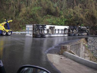
Shortly after we passed the truck, we had climbed so high that we were in the middle of the cloud bank and our visibility seriously deteriorated. So, it’s raining, foggy, and we were on a dangerous windy road, which is pretty scary. But it gets worse. There was a fairly large amount of traffic on the road, and much of it was slow moving big rig trucks. Cars in both directions were passing these big rigs, which was really frightening since there was such little visibility. But they were often passing on blind curves, which was terrifying. Needless to say, we were moving slow, and were beginning to worry that we wouldn’t make it to our hotel before dark. We had been warned multiple times that we should not attempt to drive after dark in Costa Rica. After being on this road, we completely understand why.
The road situation never really got better until we reached San Jose. While the rain was light most of the time, there were plenty of points in time where it came down very, very hard. The fog varied in thickness, sometimes being so thick we could barely see the car ahead. And we just kept climbing up and up. At one point we checked the altitude on the GPS and saw we were at 10,650 feet. It had gotten to be pretty darn cold. We had the heater on and were wearing our flimsy jackets. We had to stop at a checkpoint and roll down the window to talk to the officer and we thought we’d freeze. We feel sorry for her that she has to stand in the cold rain. It is amazing that at sea level it can be so ungodly hot while so cool farther up.
To be continued”¦
