
Friday, August 22 — As predicted, the hurricane passed on Wednesday night/Thursday early morning with little effect on Baltimore. Conditions were more severe in Norfolk, so we were glad we’d moved. Yesterday was another cool day, with 10-knots of sustained wind with occasional gusts in high teens, no rain, and temperatures in the 60s.
Yesterday morning, the alternator belt that Eric had ordered arrived, and he installed it right away. The one he’d ordered was 1/2″ less in diameter than the belts he’d been using, and he was pleased to see that it was a perfect fit! There was just enough room left for adjustment. He also ran main engine and cleaned one of the sea strainers. Surprisingly, it was clean. We were worried they’d be muddy and full of creatures like they’d been in Little Creek.
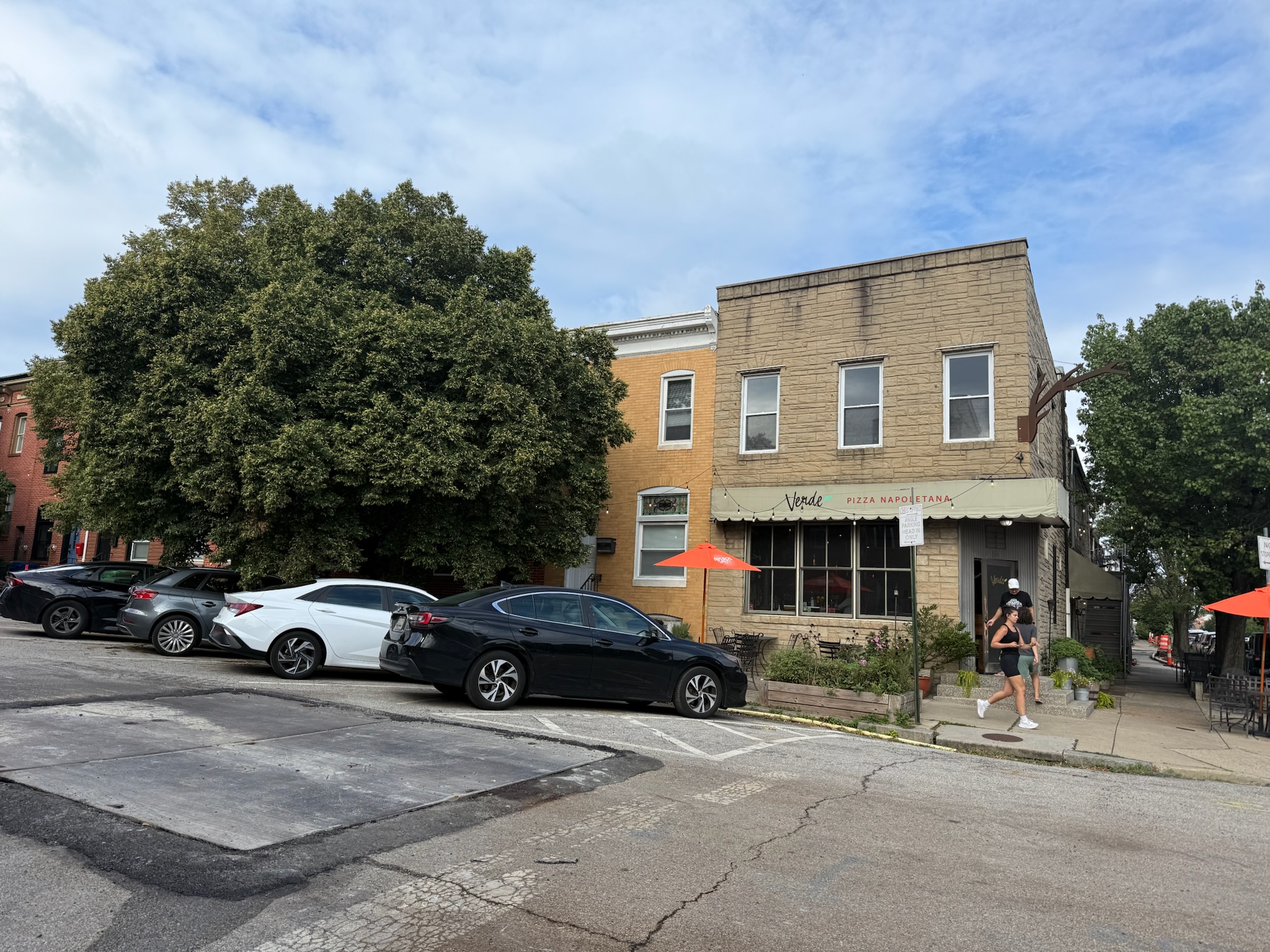
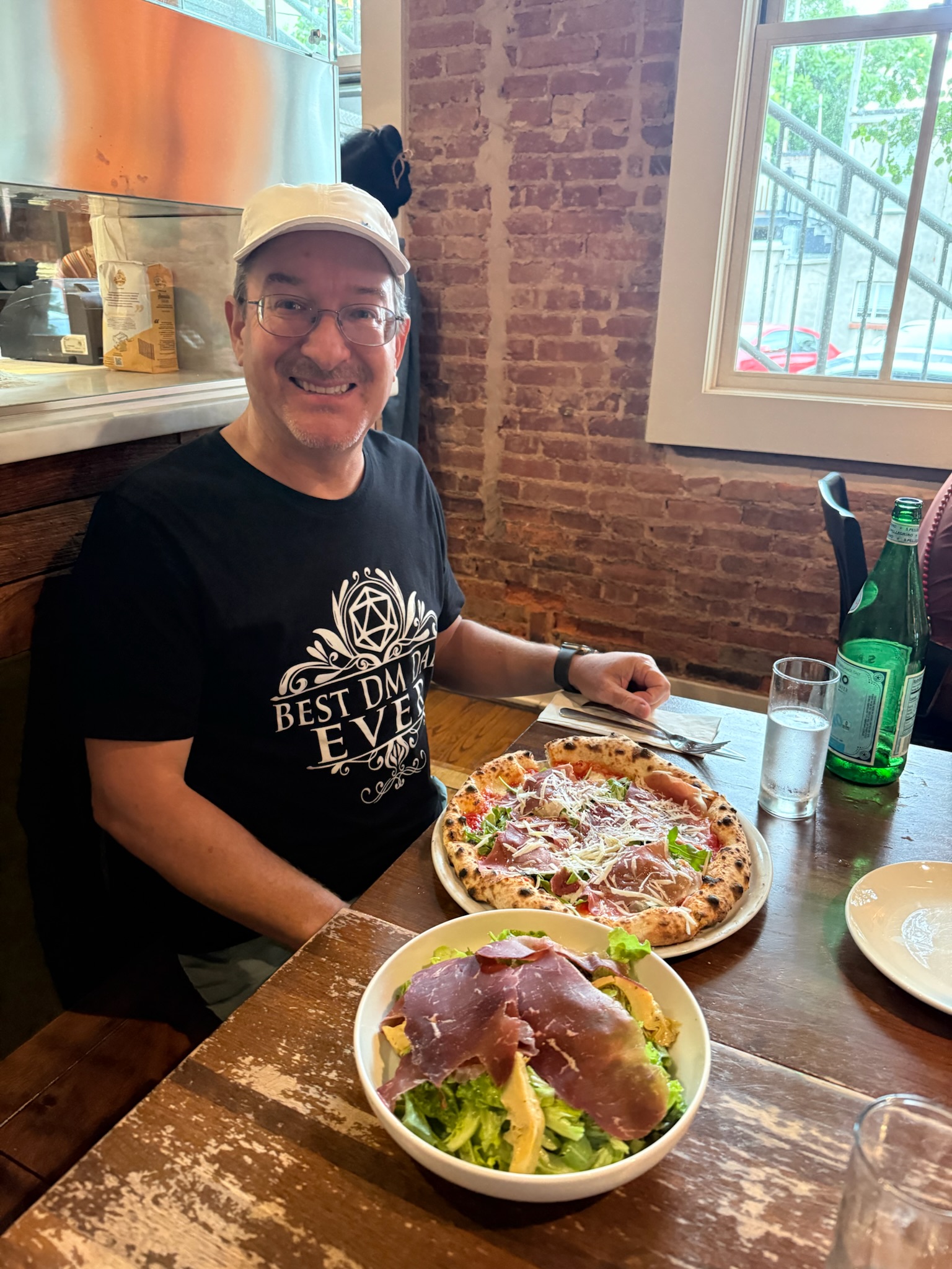
In the early afternoon, we went to Sprouts, which we knew had some particular items we wanted to stock up on, and then to Target for a more general stock up. In the evening, we had dinner an Italian restaurant in the neighborhood called Verde. They had Napolese style pizza, which was our preferred type of pizza. The cheese was made in house, and it was amazing.
This morning, we walked up to a foul odor. There were thousands of small dead fish floating in the bay!
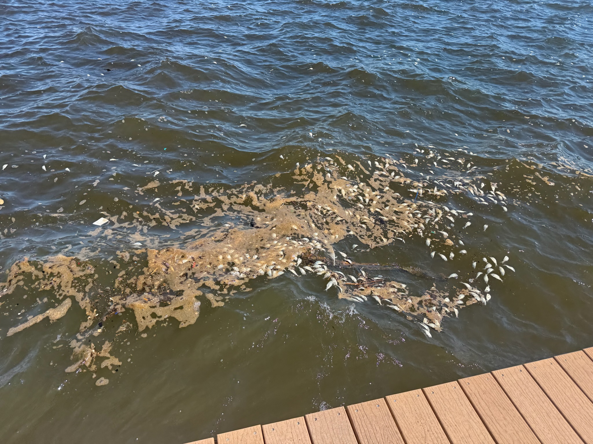
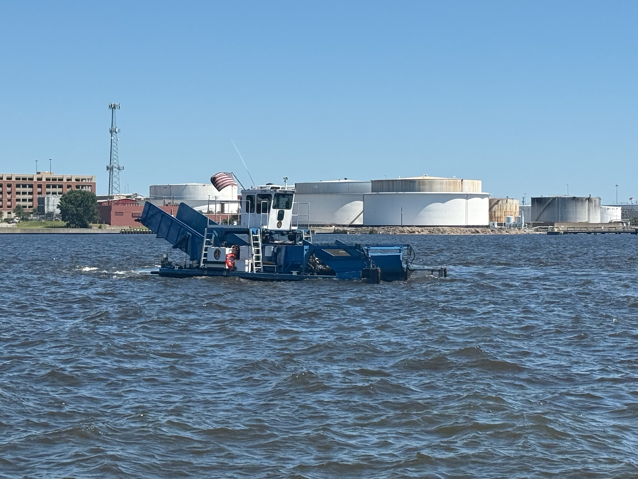
When we asked what was going on, our neighbor explained that it was a natural phenomenon that occurred every few years. We hope we’re remembering what he said correctly. If not, please correct us in the comments: there was a bacteria or algae or something that lived on the bottom. It didn’t bother the bigger fish that lived down there. But when the air was significantly lower in temperature than the water, the bacteria or algae came up to the surface and killed off the little fish. We asked if they were poisonous since the birds didn’t seem to be eating them. He said no, that the birds were simply full because there were so many fish available to eat. There was a vacuum boat sucking up all the excess fish, and he said there were two more vacuum boats in the bay, as well.
Since we wanted to escape the bad smell, we decided to go to the Chesapeake and Ohio (C & O) Canal, which was a 184.5 mile national park that paralleled the Potomac river from Maryland to Ohio. It was built by The C & O Canal Company and was a working canal from 1850 – 1924. It was now a national monument.
We were just walking out the door when the diver we’d tried to hire a few days ago called and said he was on his way. When Eric had first talked to him a few days ago, it sounded like the diver had more clients than he could handle and was having a hard time fitting us into his schedule, so we weren’t expecting to hear from him. Eric was thrilled that he’d managed to fit us in. Eric wanted to talk to him about the keel coolers and speed sensor, so we postponed leaving.
Given how much growth we’d gotten in Little Creek, Eric had been anxious about how much growth there was now. Eric was relieved when the diver said there was a lot of soft growth, but overall, it really was not bad. The diver left at about 1445 and we immediately headed out.
There were three entrances to the park. We decided to go to the Great Falls entrance in Maryland, just outside of Washington DC. The drive took a little over an hour. Once we got off the freeway, we knew we were in a high-end neighborhood from the large, immaculately maintained homes on large lots. The closer we got to the park, the more grandiose the homes became.
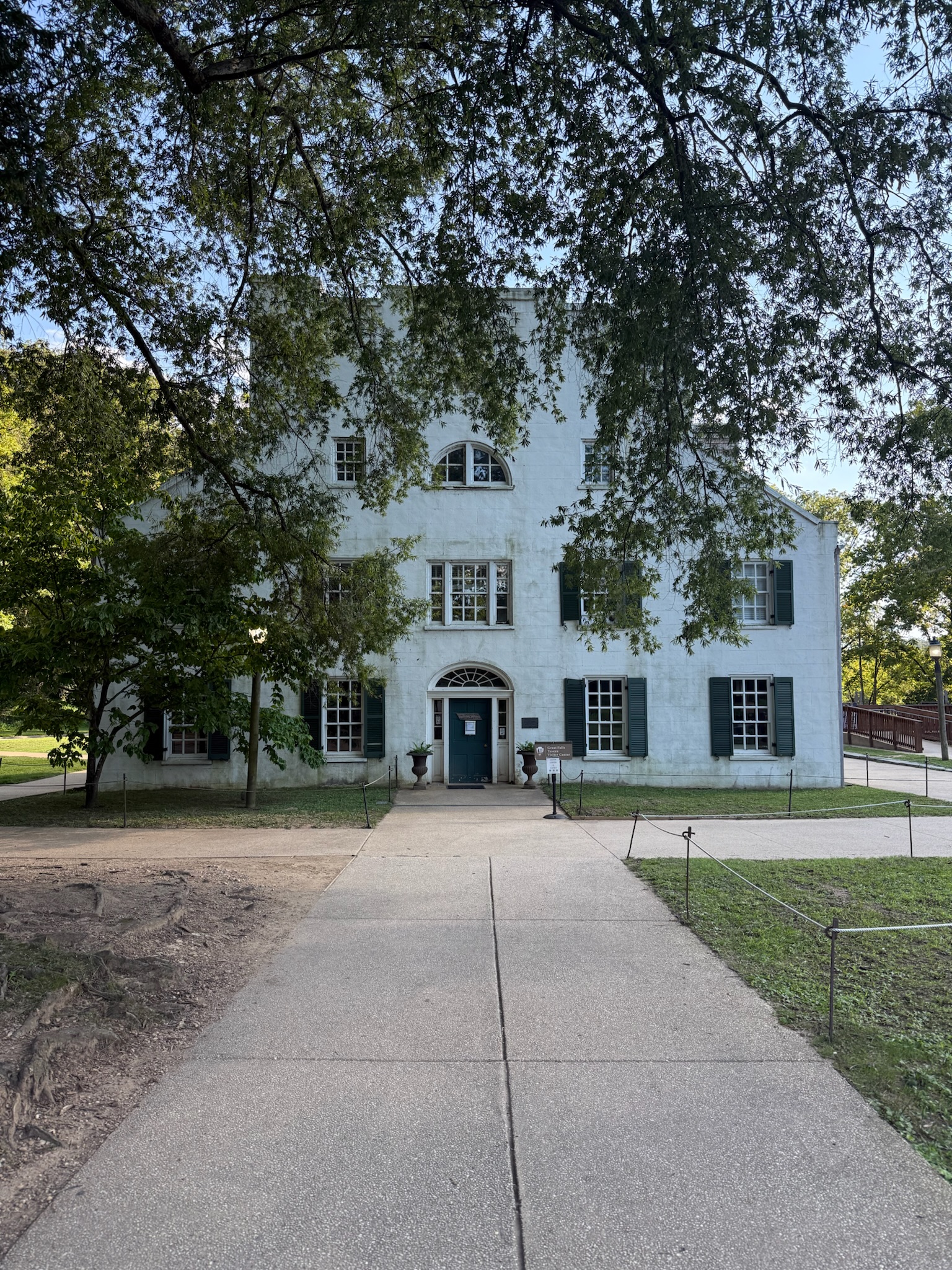
When we arrived, we found out this entrance cost $20 per standard car + all passengers, but the other entrances were free (as an FYI, it would have cost $10 per person if we’d been dropped off by a bus, so it was cheaper for us to go by car than bus). The path from the parking lot took us to the Williamsport visitor’s center. The sign outside the building said that the building was originally the lock keeper’s home. Built between 1828 and 1831, It was enlarged twice to accommodate a hotel and tavern. It sounded like many people transiting the canal chose to stay here overnight, and that short canal rides also became a vacation destination for Washingtonians. Sadly, it had already closed for the day.
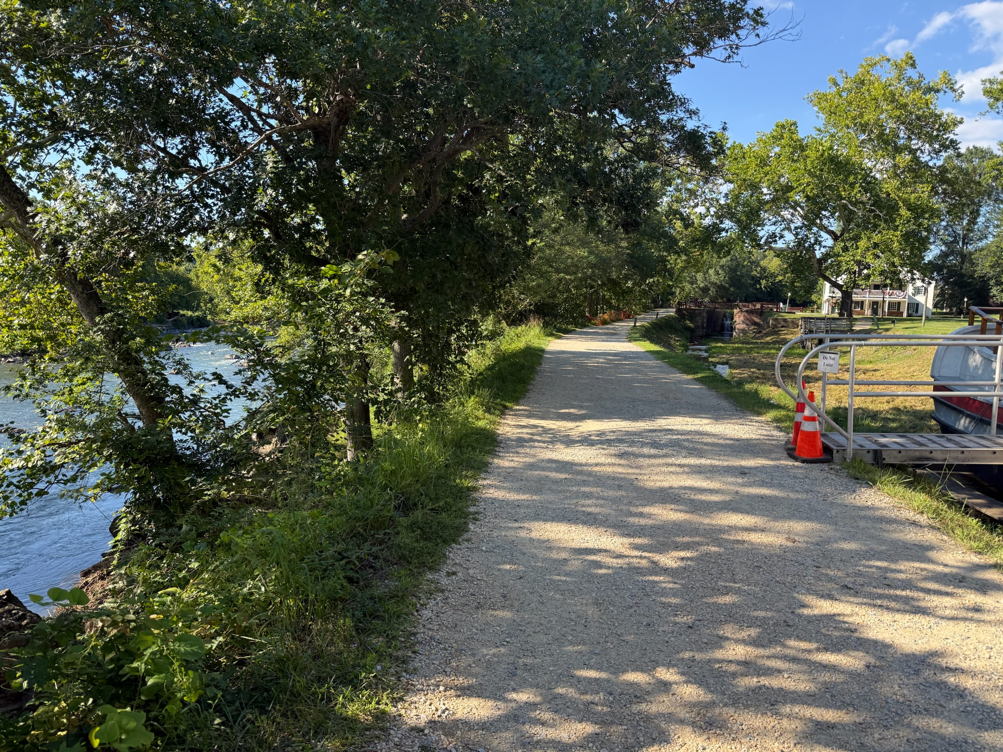
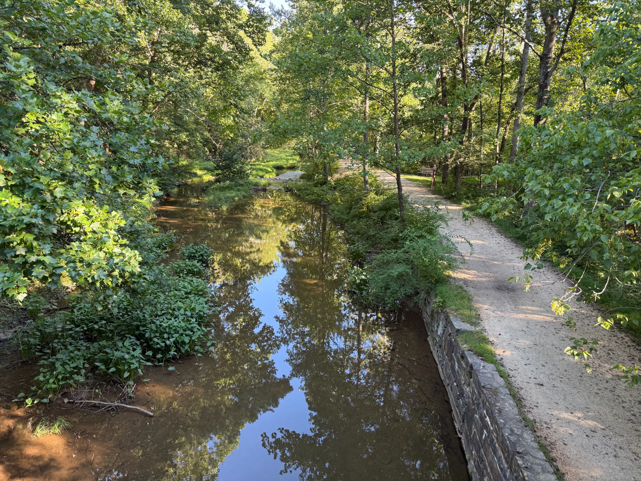
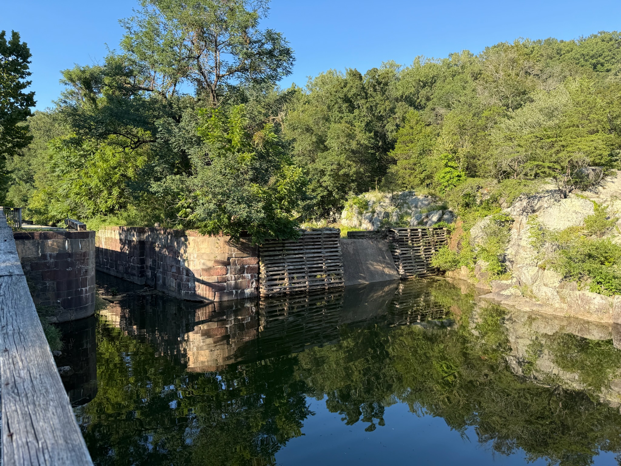
We crossed over the small foot bridge onto a dirt path that ran between the river and the canal. From the bridge, we had a great view of Lock #20. We were shocked at how tiny the canal was. The sign said that the dirt path was called a towpath. The canal boats were loaded with cargo, and mules walked along this path pulling the boats with them.
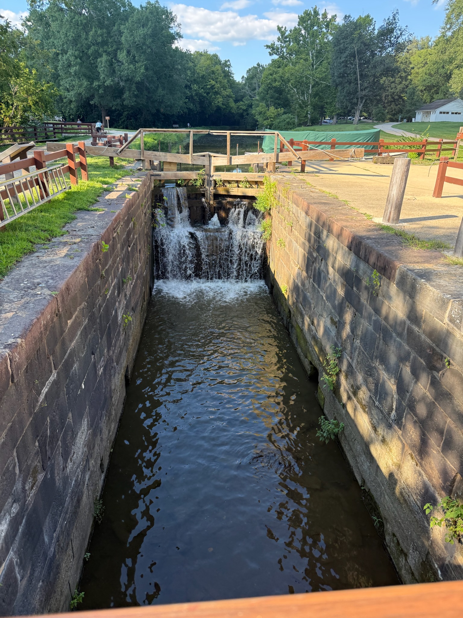
This was the view from the other side of the lock.
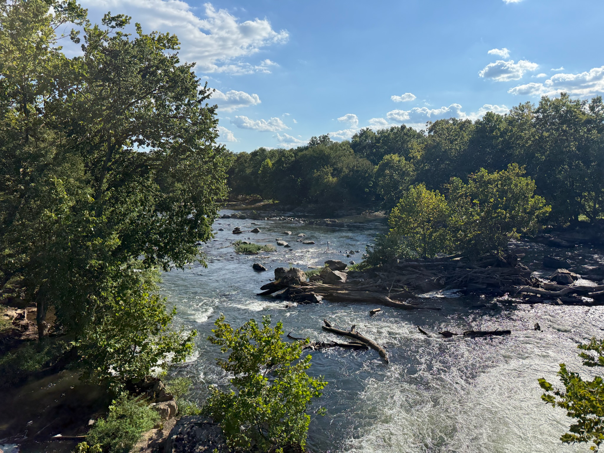
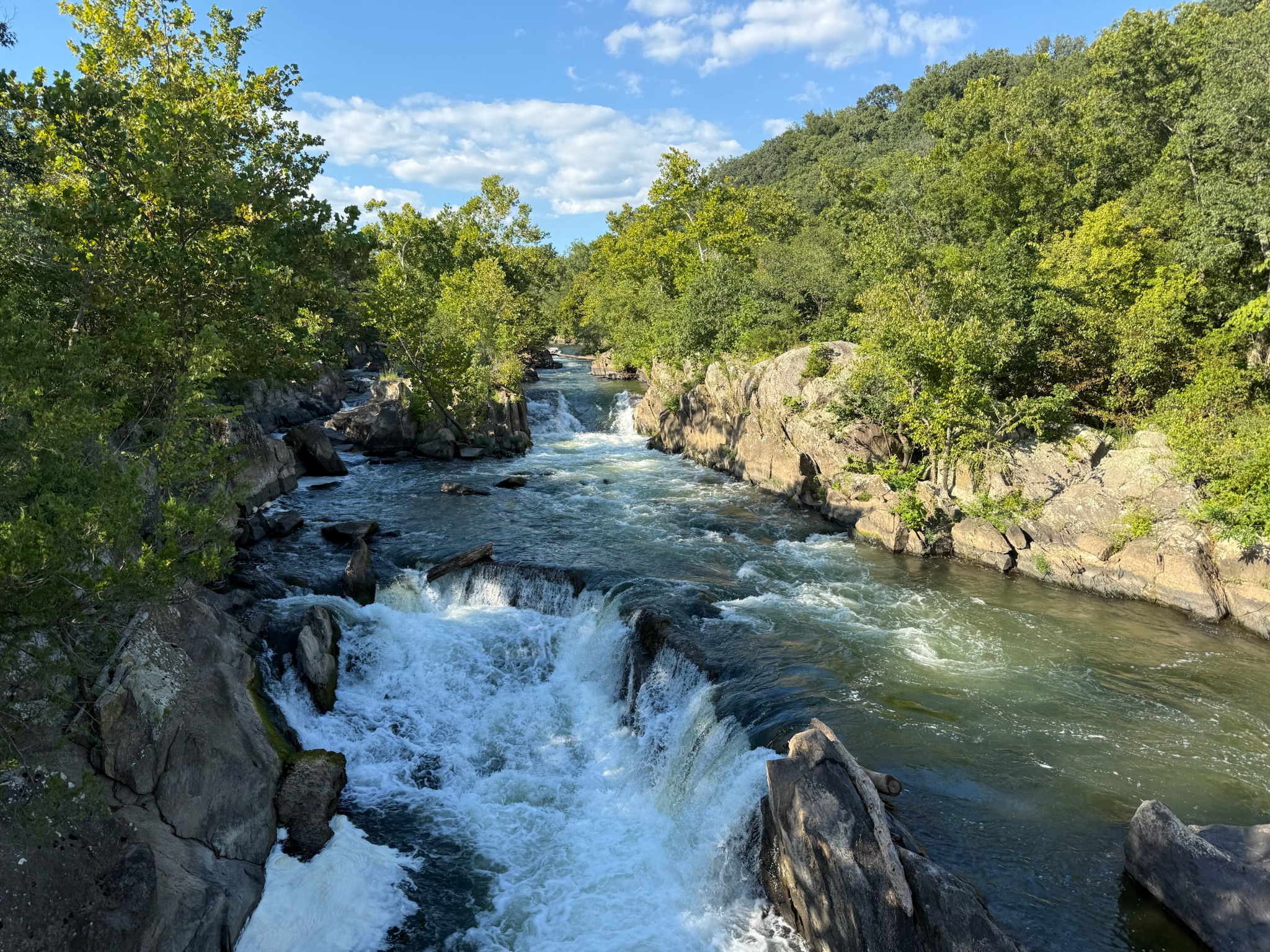
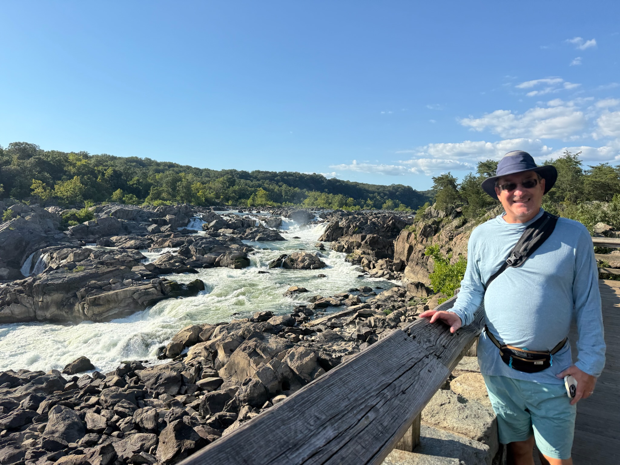
We went over to the observation deck and looked at the river. It was rocky. The sign said that Great Falls was one of the most challenging sections of the canal, as the river plunged 41 vertical feet. The drop was mitigated by diverting some of the river water off into a separate waterway with six closely spaced locks to safely drop the boats.
We followed the towpath south. It was a beautiful walk, with the river and its lush foliage to the west and the canal and its grassy plains to the east.
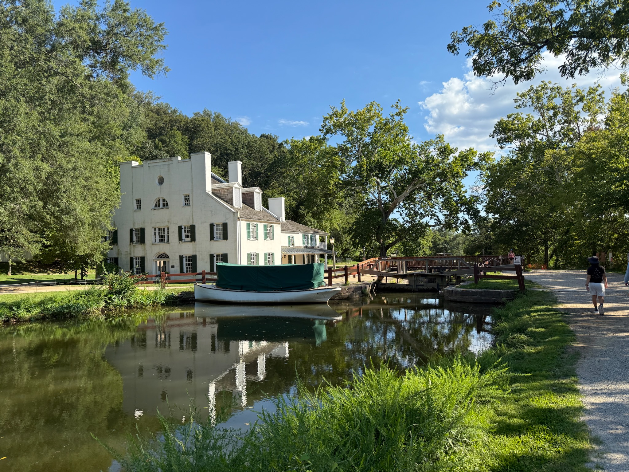
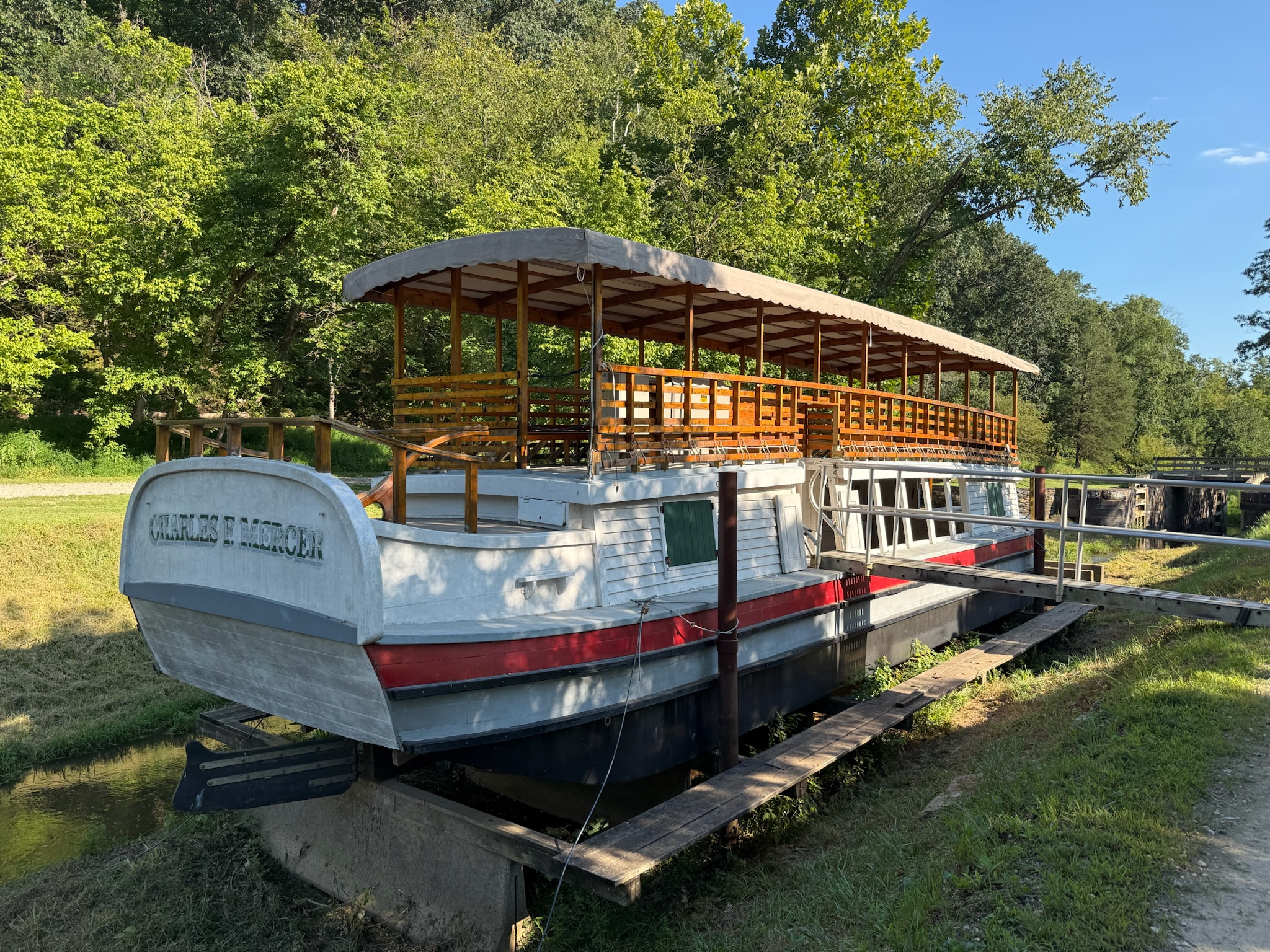
We passed a boat that looked like it was part of the museum and was once open for tourists, but was closed now.
And what we think was lock #19
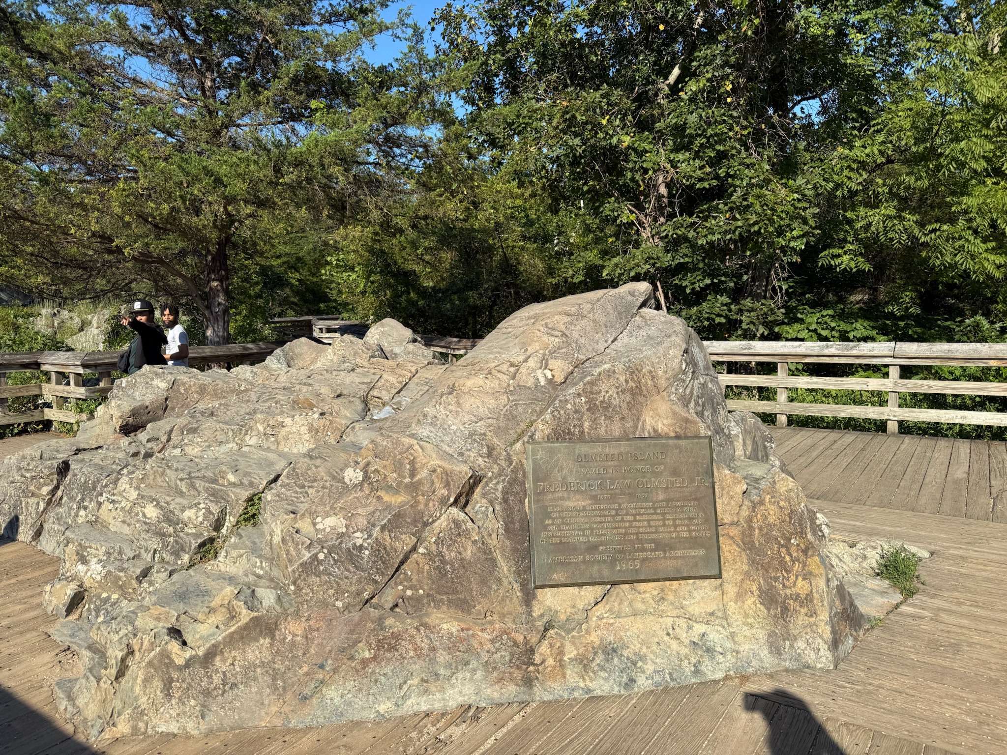
We passed another couple of locks, then took a diverging path called The Great Falls Overlook to Olmstead Island. The sign said it was a bedrock terrace forest and was a rare and fragile area. The ground was covered by a wooden walkway.
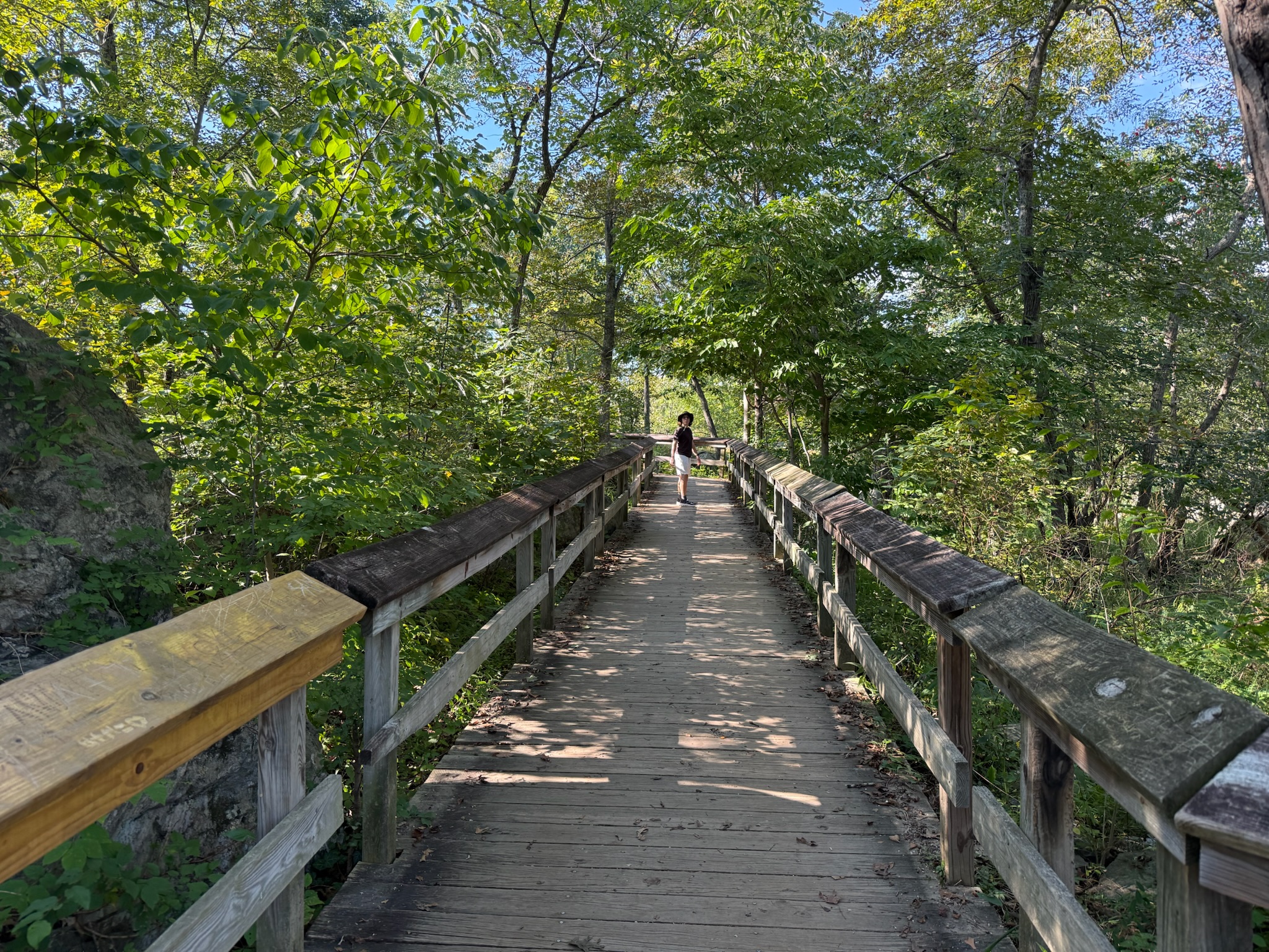
The walkway crossed over an offshoot of the canal with a lovely water fall.
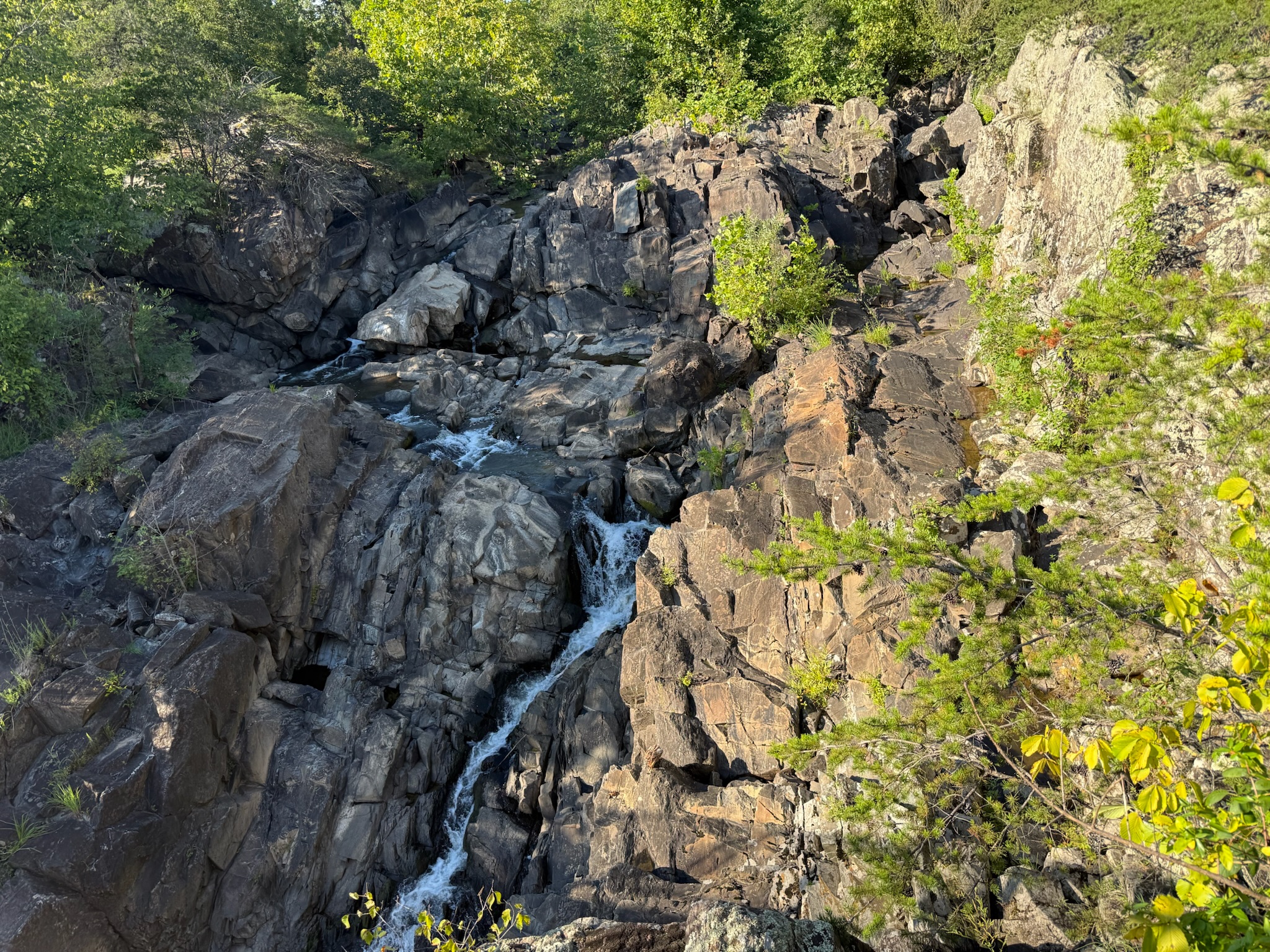
And onto the tiny rocky island. The walkway wrapped around a big rock.
And ended at another waterfall. The sign said it was the largest fall on the Potomac, dropping 60 feet. Between here and Washington DC (which was 10-miles downstream), it dropped another 85 feet in total.
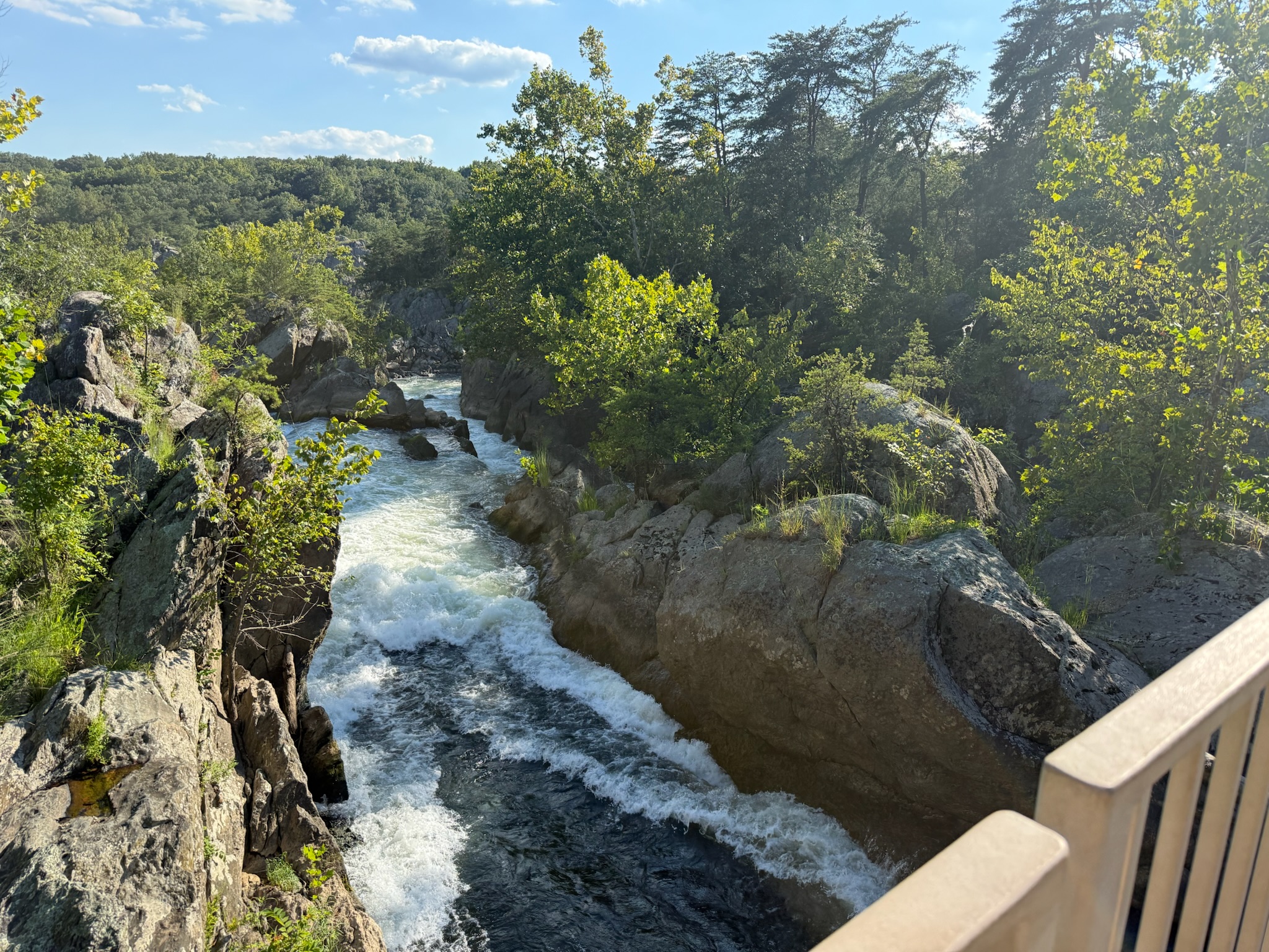
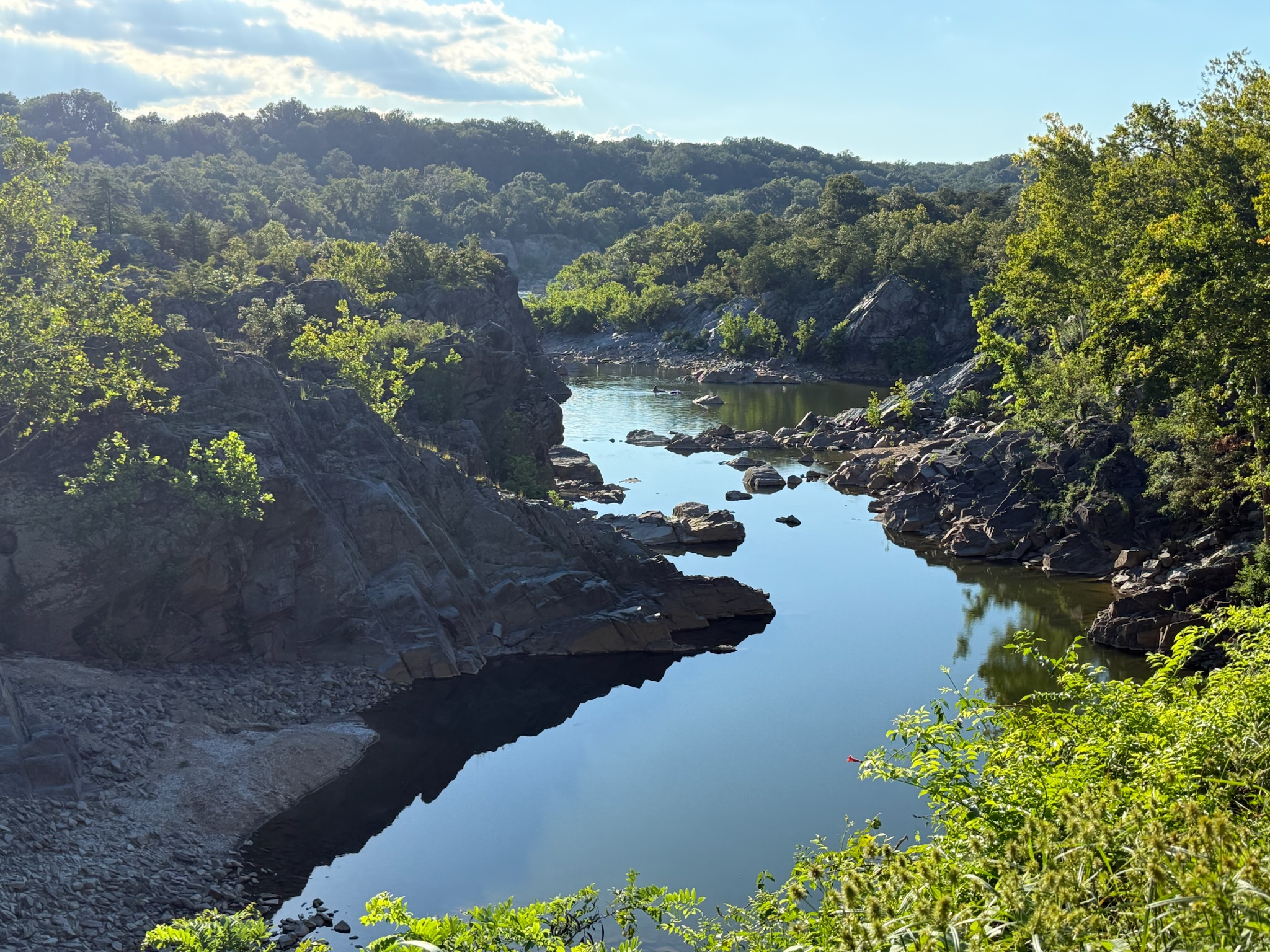
We backtracked to the towpath. Not much father along, we passed an especially scenic little tributary off the main part of the river, which the sign called a “natural geological barrier.” There was a kayaker in the water! You can see him if you look really closely.
Just beyond the spot those photos were taken was another offshoot trail called Billy Goat Trail that led to Bear Island. The signs said this was a strenuous path, so we skipped it and continued on the towpath. Soon we came to a covered bridge
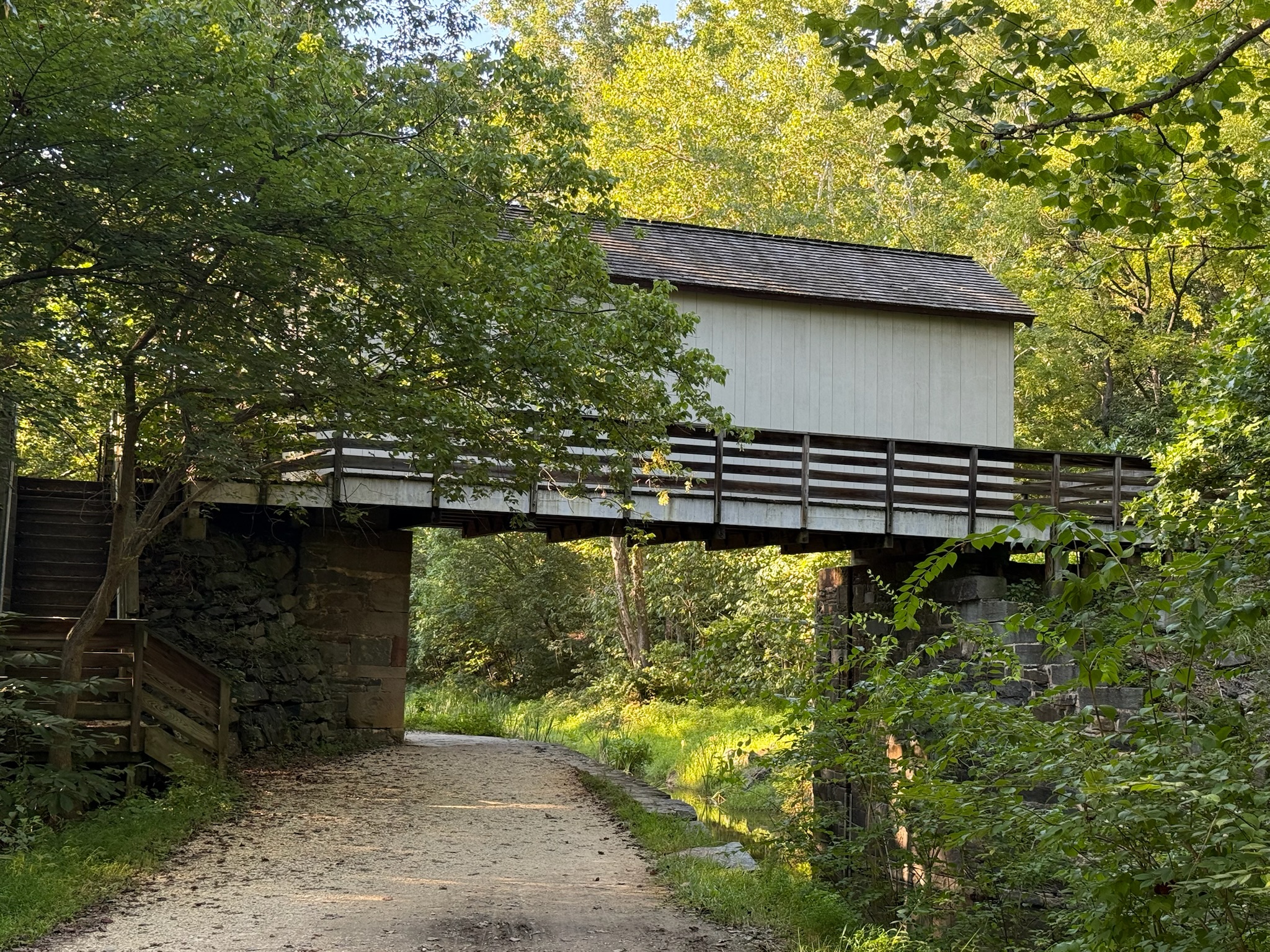
Christi ran up the stairs, hoping to go inside. However, the doors were locked. Here was the view south from the top of the staircase. Even though you can’t see it through the foliage, the river was to the right.
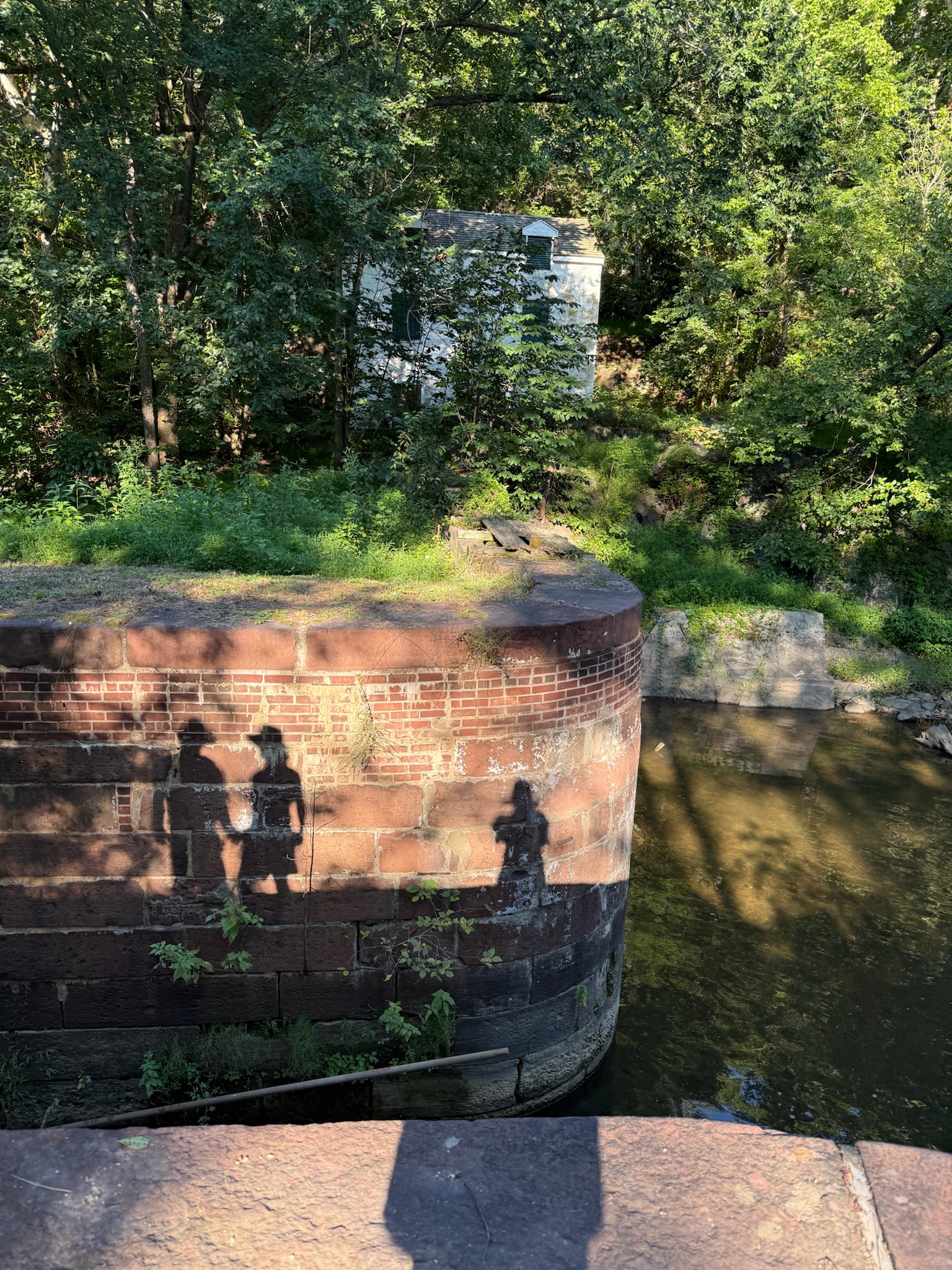
At lock 16, we saw another building that looked historic on the other side, but we didn’t try to go over to the other side to see it.
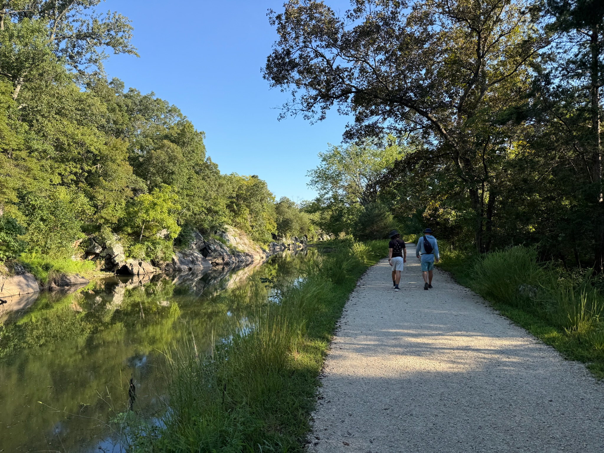
The farther south we got, the more water there was in the canal. It was calm and reflective, making the area feel serene and peaceful.
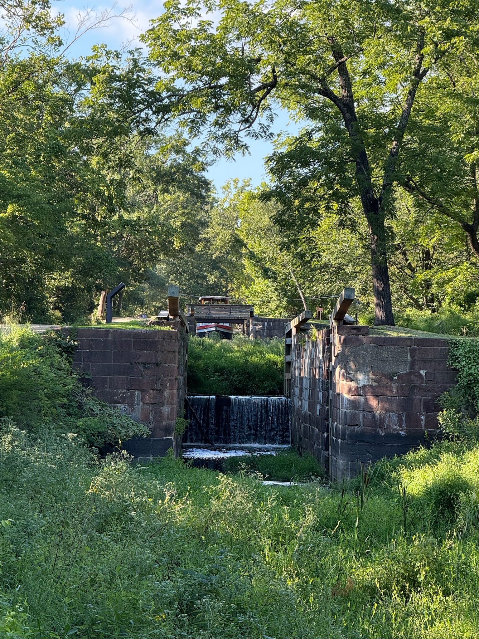
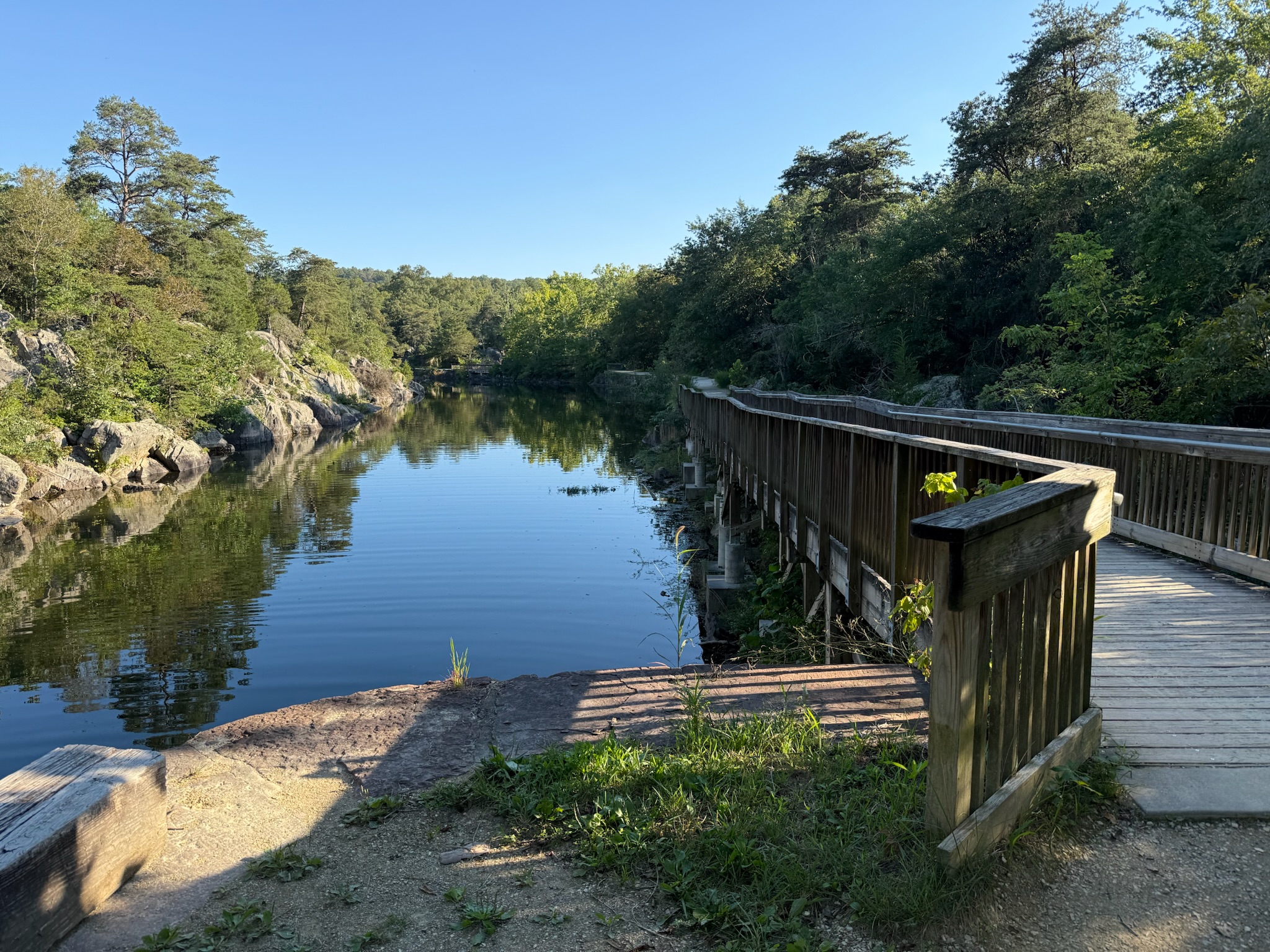
At lock #15, the towpath turned into a wooden walkway. One of the signs we’d seen along. the way had said that one of the reasons the canal eventually closed was because of issues with flooding. We wondered if this was an area that was prone to flooding and NPS just let it go natural or if this really was how the canal was back then.
Lock #15
We decided this was a good stopping point and turned around. We were actually glad that we’d arrived much later than planned. It was probably a more comfortable walk now, later in the day when the sun was lower in the sky, than it would have been at midday. All in all, we’d walked 2-miles.
Since it was rush hour, we decided to take the scenic route back to Baltimore… to be continued…