
This morning we were up early to go to a festival in the town of Lakepa on the other side of the island. Eric and Gisela joined us. Lakepa happens to be the next village over from where we ended our island tour on Thursday, so after the fair we would continue the island tour. Several people had told us to be at the festival by 0730 or 0800 to get good food. It would be over by noon at the latest. We have noticed that in Polynesia, they tend to get an early start on the day. All the markets begin at or before dawn and are over by 0800, which is why we have never gone to one.
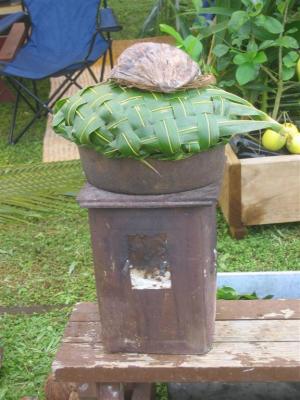
There was a grassy area with a dozen food booths spread around. Most of the booths had similar food choices, which were barbeque and taro. We found a booth that was selling the traditional Niuan breakfast food called coconut porridge. It was served in a coconut half shell. The broth is clear and has the consistency of egg drop soup. There are tons of chunks of cooked coconut and some chunks of cooked arrowroot. The arrowroot is chewier than the coconut. It tastes just like coconut. We also got a barbeque plate to share. It was piled high with a sausage, a piece of steak, several pieces of chicken, curried whole shrimp (including heads and little beady eyes pleading with you to not eat it), fried fish, and big pieces of boiled taro. The fish was fishy, but everything else was good. We also got some banana cake and a dessert that had a layer of white cake, a layer of custard, and was topped with fruit. Neither was very sweet. There was also a lady making uga the traditional way. She wrapped the uga in coconut leaves and put it on top of a pot of boiling water to the crab is steamed. She used an old fashioned stove.
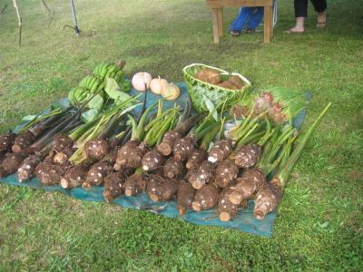
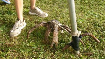
There was a tent set up with a group of chairs underneath. The front rows of chairs were occupied by what we assumed were the town’s elders. Each of them gave a long speech in Niuan which it appeared everyone in the crowd completely ignored. There were two carnival games. The first one was to throw a metal ball into circles painted on the grass. The second one was where they gave you a golf club and a golf ball sized wiffle ball and you tried to hit a mark roughly 20 yards away. This was especially tough since the wind was blowing the other way. There was an astro jump. There were a few vendors selling produce, a booth wooden carvings, and a booth selling embroidered bed and window coverings and dried flower arrangements. There was a truckload of baby pigs. There were several large uga tied up to booths like they were pets. It was an interesting scene.
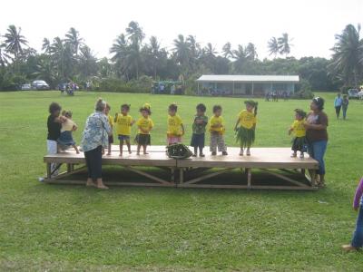
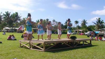
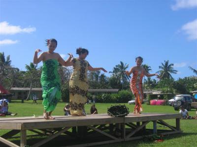
When the elders were finally done speaking, a javelin throwing competition began. We suppose these are traditional weapons. The javelins are weighted at the front. While the javelin competition was wrapping up, the dancing began. There were a total of 10 or so dancers that ranged in age from two to early 20’s. They all did several dances. The Niuan dances are slower than the ones in French Polynesia, closer to Hawaiian style dancing. The music they played was more of an upbeat reggae than the pounding rhythmic music we heard in French Polynesia. They had a basket on the stage to throw money into, but we noticed that most women actually hopped onto the stage and put money in the dancer’s tops rather than throwing it in the basket.
With the dancing completed, the fair seemed to be over and we hopped into the car to go look for some more caves. There is a tour guide named Tali that takes you on “amazing” cave tours. Tali only does the tours on Wednesdays, so we had missed our opportunity to go with him. The tourist map had the spots on his cave tour marked, so we decided to go see these amazing caves on our own. We drove up and down the main road three times before finding the small, unmarked turn off to the caves. It was another overgrown road, but this time it was short.
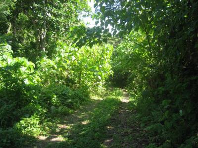
The road ended and became a footpath. We followed the footpath for a good ways. The scenery was very similar to Togo, with it beginning as dense trees and a little coral and the coral getting bigger and denser and the trees fewer. The path let out at another Bryce Canyon like cliff, though this one wasn’t as dramatic as the one at Togo. From there the path just ended. We knew we were probably standing on top of the cave, but for the life of us we couldn’t find the entrance. We gave up and went on to the next destination, Uluvehi.
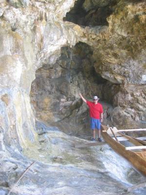
This spot wasn’t listed as a tourist spot on the map, but was in Eric and Gisela’s guidebook. It is where the outrigger canoes were landed in the old days. The guidebook said to take the road next to the streetlight across from the monument in the town of Mutalau. There were two parallel roads next to the streetlight, so we picked one. Of course, it was the wrong one. After quite the detour that probably significantly shortened the life of the rental car, we headed down the other road. It was a short, steep drive that ended at a cliff. There was a staircase down the cliff to the water. In the cliff were a couple of caves that housed a few outrigger canoes. You can just see the edge of the canoe in the cave with Eric in this photo.
The guidebook said there was another cave there, as well. There was a big sign up the road saying Lima and pointing to another overgrown small dirt road. We followed the road to it’s end, got out and looked around. No luck finding this cave, either. Caves are certainly harder to find than you would think. So far, we have only found the ones with very clearly marked trails. Anything with less obvious markings has completely eluded us.
The next stop was Matapa. We finally, after three days, had completed our tour of the island. The entrances to the two sites were side by side. We went to the arches first, since it was a longer walk. We figured we’d cool off after the hike in the water at the chasm. The sign said it was an easy 15 to 30 minute walk each way. It was easier than any of the other hikes in terms of how steep it was, but it was still rough, jagged, rocky and uneven ground. Not quite so easy as advertised. The trail ended at the mouth of a cave. To the left there was another mouth right on the ocean with a view of an arch.
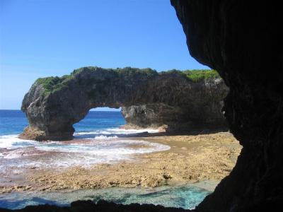
To the right was a third mouth with a view of two more arches and a chasm below. You could climb down some rocks into the chasm, surrounded on three sides by solid rock and on the fourth side by these three large arches gracing the shoreline. It is a gorgeous site. There were a couple more caves in the cliff walls. Christi and Gislea climbed up one of them and explored the cave. We could easily see how a tribe of people could happily live in these caves with the valley and ocean below them.
Once we emerged from the arches trail, we headed down the chasm trail. It was a short hike ending at what looked like a crack between two cliffs. The walls were 100 feet tall and it was about 50 feet wide and a couple of hundred feet long. It looks as if you can swim beyond the chasm into another protected coral pool similar to the one at Lima. Unfortunately, our camera ran out of batteries, so we have no photo of it. We were going to go snorkeling, but we were pooped. We had been up early and had a long day of hiking. There were a few locals there and they said it was a nice snorkel, but that there were better spots at other parts of the island, so we didn’t feel too terrible about missing this snorkel spot.
We sat at the chasm for a while, enjoying the view and just sitting before heading back to Kosmos for the night.