
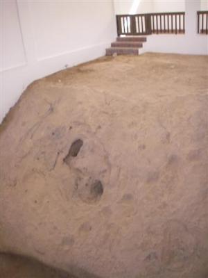
Yesterday, we had arranged for a guided tour of the area. Peter, from a neighboring boat in the anchorage, joined us. Our tour guide, Saleem, picked us up at 0830. The first stop was a small building in the heart of town, near to the souq we had gone to a few days before. The signs were all in Arabic, so we couldn’t read the full story of the significance of the place, but our guide said it is a holy site where a miracle occurred involving a prophet of God and a camel. We were a little surprised to walk in and find that the building encircled a slab of dirt. The dirt supposedly still carries the marks made during the miracle, and it takes a little concentration to see the marks in the soil. Once upon a time people were allowed to walk on the soil and go into a cave that you can’t see in the photo, but now it is closed off to the public.
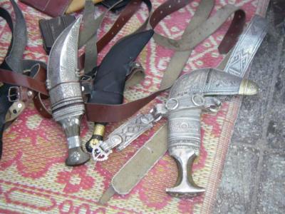
Stop two was the gun market. It turned out to be about 30 men sitting along the side of a bank building on a corner across the street from the souq. Most of the men are villagers. Some of the villagers wore turbans that had some material hanging down in back to cover their necks, and a couple of the older village men had on a long skirt and no shirt or head cover. Everyone there was holding a small rifle. There were a few vendors selling rifles, but there were also vendors selling camel skins, hand made knives in beautiful sheaths (pictured below), jewelry, leather goods, and other assorted handicrafts. There was even a guy there selling fruit. One guy came up to us and showed off how well crafted his knives are, encouraging us to touch the blade and point. The guide told us that most days there was a bigger selection of guns. Non-automatic guns are perfectly legal in Oman and do not require any kind of registration. However, it is illegal to shoot a gun in the city, only outside of town. The guide explained to us that guns are an important prop in the cultural dances.
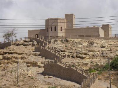
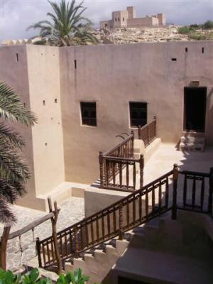
Stop three was the castle/fort in the village of Taquah, east of Salalah, on the coast. Like Mirabat, today it is a little, sleepy fishing village, but is of historical significance. We’re just not clear as to what the historical significance is. We are not sure when the fort was built, but it is definitely old. In addition to being a fort, the equivalent of the governor of the area lived there. There are two matching buildings, one at sea level, and one just above it on the hill. From the outside, they look like something out of “Sir Arthur and the Knights of the Roundtable”. This is a photo of the one at the top at the hill.
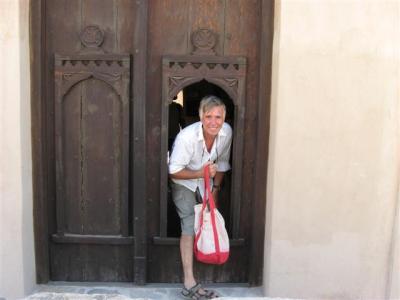
We walked in through a small door set inside a bigger door into a hallway lined with pillows on the ground along the floor and guns hung along the walls.
The hallway led into a courtyard. Standing in the courtyard, it feels kind of like a southwest Native American adobe pueblo village. The buildings around the courtyard are two stories, and you can walk on the roof. There is a three story watch tower in one corner. The staircases are narrow and steep, and all the walkways are narrow.
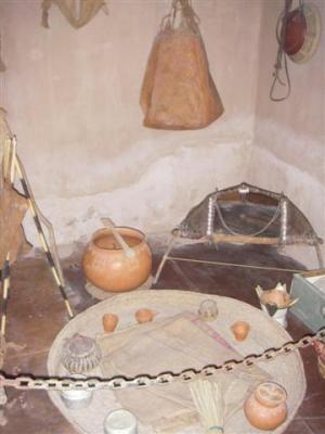
Off the courtyard there is a prison, which was surprisingly small. As you turn into the main building and go down the hall, you pass an assortment of rooms, such as a prison, food storage room, weapons storage room, kitchen, etc. Almost all the rooms have guns hanging on the walls. Accoutrements typically used in each room during its era of use are on display. There is a lot of plain colored, clay pottery, which adds to the southwestern Native American feel. This is the kitchen.
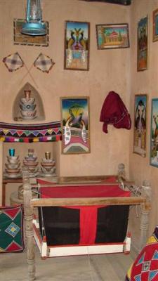
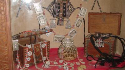
Most of the upstairs of the main building is the private quarters of the governor and his family. Here are a couple shots of the decor and some of their belongings that were on display.
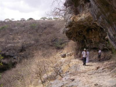
We didn’t go to the upper building. Instead, we hopped in the car and headed up into the mountains to a place called Shihayt. We parked in a parking lot and followed Saleem down a fairly steep, rocky, dry stream bed full of dead (hibernating?) stumpy trees and bushes down to a giant sinkhole. The depth of the sinkhole is unknown. The deepest exploration was 50 meters, and they still couldn’t see the bottom. The locals believe bad spirits inhabit the hole and won’t go near it. In the background of the picture you can see the flat area where we parked, and get a sense of the terrain and steepness going down to the lip of the hole. Eric is standing on the lip, the hole is to the left.
To be continued”¦ [91]