
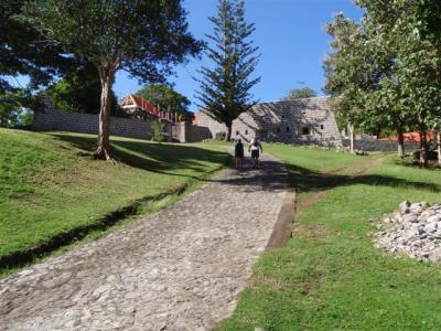
The other day, Barb and Chuck had invited us to go visit Cabrits National Park, on the Cabrits peninsula right near where we are anchored. We had mentioned on the day that we arrived that the north end of the bay had a few isolated buildings and a nice dock. We later found out those are part of Fort Shirley, a restored old British fort on the Cabrits peninsula. We had enthusiastically accepted their invitation and made plans to meet them on shore this morning. Another cruising couple joined us.
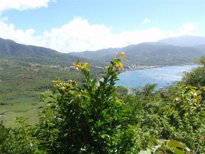
We walked north along the main road that parallels the water to the park entrance and got tickets. At the entrance there is a small, but informative, museum in an old gun powder magazine. Cabrits is an extinct volcano, and was originally an island off the shore. Over time, the volcano broke in half, and each half has been eroding away, so now it is two hills with a very small plateau between them. Meanwhile, the gap between the volcano and the shoreline filled in with silt, turning the island into a peninsula. In the “Welcome to Portsmouth, Dominica” post there is a photo of Prince Rupert Bay. In it, to the left you can see one of the two Cabrits hills, then the low land, then the taller mountains of mainland Dominica.
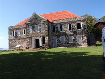
What we could see of Fort Shirley from aboard Kosmos was nestled in that small valley between the two mountains, and we were under the impression that was all there was to it. We were most surprised to find out that the fort encompassed 200 acres, taking up most of the island. In it’s hey day, the fort had over 50 major structures and housed 600 men. Portsmouth is a natural harbor, and a good place for ships to stop to get food and water en route to other places. The fort was built to protect the re-provisioning ships, as well as to defend the island from the French based on nearby Guadeloupe.
The construction of the fort was done primarily by slaves that were rented from the plantations to do land clearing, building and maintenance. The buildings were made from local volcanic rock and/or red clay bricks imported from England. Coral was heated in on-site lime kilns to make the mortar. Like Nelson’s Dockyard, it was a fully functional ship facility with ship building/repair, carpenters, smiths, wheelwrights, artisans and engineers on staff.
In late 1700’s, the British decided too many troops were dying in Portsmouth from disease, and decided to replace the whites with black/Creole troops, believing blacks were hardier. The commander treated the black troops unbelievably bad and screwed them out of their pay, so the troops revolted in 1802. The commander was put on trial, but instead of convicting him, the British simply forced him to retire. But in 1807, the British did give the entire regimen their freedom 10,000 people. Given how badly all the British military was treated back in those days, we can’t imagine what the commander could have done that was “so bad” by British standards that the British were willing to set the troops free. It must have been heinous beyond belief.
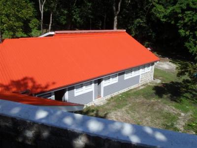
Fort Shirley never saw any action in battle. In 1854, the base abandoned and nature reclaimed the fort. In 1982, restoration efforts began on the fort. Surprisingly, the buildings had stood the test of time and were still standing. In 1986 Cabrits was declared a national park. In 1990, they built cruise ship terminal on exact site where old dockyard used to be, sort of recreating the feel of the old days. Ah ha! The nice dock is a cruise ship terminal! Although, to the best of our knowledge, it looks like it isn’t used for anything at all.
From the museum, we walked up the neatly groomed hill up to the plateau towards the buildings we could see from Kosmos.
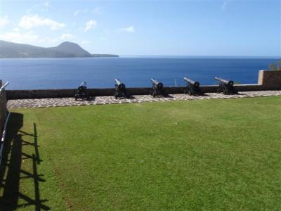
Quite a few buildings have been beautifully restored, and it looks like they are actively working on the rest. There was a construction crew actively working away. The first picture is the officer’s quarters, the second is the signal station at the upper battery, the third is some of the cannons on the upper battery and the fourth is the troop’s kitchen. We’re not sure, but it sounds like the troops were given rations of raw ingredients and the men cooked up their own meals in the communal kitchen.
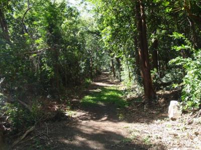
From the refurbished area, there are several hiking trails that lead through the woods. The woods are thick and lush. When the fort was in use, all the vegetation on the grounds had been completely cleared away. It must have been a tremendous amount of work to clear the dense trees and maintain the clearing. It is also amazing that after almost 100 years of being cleared, that the forest managed to regenerate itself.
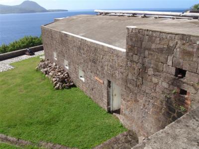
Barb and Chuck have been here several times, and they led the way. They took us on a trail that led up to the north side of the western hill and a pretty viewpoint of Douglas Bay, where we had gone diving a couple days ago. Then we followed another trail down hill along the north side, into the plateau. It took us to Douglas Bay Battery, basically a fort wall lined with decrepit looking cannons still poised for firing. When the trees were cleared, this spot must have also offered a fabulous view of Douglas Bay, but now all you can see are trees. Behind the battery are the remains of another officer’s quarters building and a kitchen.
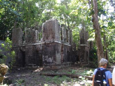
The ruins here kind of remind us of Ross Island in the Andaman Islands. There is just the shell of the buildings left, solid brick walls with no roofs or windows or doors or anything else. Fichus tree roots grow in and amongst the bricks in the wall, with the tree trunks starting at the top of the walls. Some of the fichus trees are really tall, with their branches towering high up overhead. It is the weirdest thing to see. It is not nearly as dramatic as Port Ross, though. In Port Ross, pretty much every single inch of every building was covered in roots, and here the growth is comparatively sparse. But there are still enough roots on the walls to make one gape in awe at Mother Nature’s power. We read in the museum here that the fichus trees thrive on the lime in the mortar, which is why the roots grow up the walls. Oddly enough, Port Ross has been abandoned for only 50 odd years, and Cabrits has been abandoned for 150 odd years, so you’d think that Cabrits would have the denser growth.
It is hard to believe that the restored buildings on the plateau probably used to look just like this. Wow. The contrast between what has been restored and what is still au natural is amazing. It makes us appreciate how much work it really took to restore these old buildings.
We continued on, heading south on the plateau back towards the entrance. After a few minutes we came to another group of tall ruins. This was probably a fairly big complex once. If we are reading the map right, this was the commandants quarters and some stores, though the map is pretty bad, so we weren’t sure. These didn’t have nearly as much fichus growth, and had several interior walls intact. We poked around inside a little bit and found a huge cache of little tiny cannon balls that were not too much bigger than donut holes. Or, maybe they are giant round bullets.
After spending a few minutes there, we took a path that headed up the eastern Cabrits hill. We came to yet another ruin, what appeared to be a bunker of some kind set inside a retaining wall. Once again, it was hard to tell on the map, but we think it was once a guardhouse, powder magazine, water cistern, and storage facility. The bunker looks like it is mostly collapsed, but the retaining wall looks to be by far the most intact of all the structures we had seen here in the woods. We climbed up the stairs inset in the wall and followed the steep path up hill to another viewpoint on the eastern side of the hill where we could see Deep Bay, Prince Rupert Bay and the low land between them.
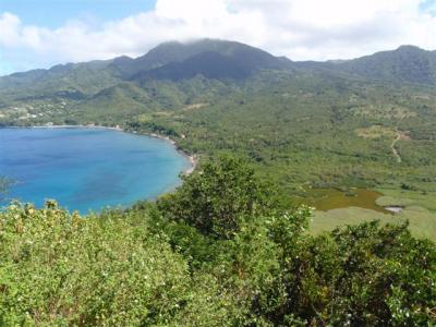
From here the path continued up the hill, but the trail beyond this point wasn’t very well maintained. The farther up we went, the more overgrown it became. We followed it up to the very top of the eastern hill, which offered great views of both bays, the ocean, and the restored area below. In the museum we read that when all the vegetation was gone, all the buildings on the base had direct line of site to one another. The views were even better up here. There were several cannons strewn about, half hidden in the tall weeds. We feel sorry for the people who had to haul the cannons up here. We can’t even imagine how they got them up these hills. On one of the cannons was some graffiti. We forget the exact words and date, but it said something along the lines of “Sam was here, March 08″ and we knew it was probably 1808. It is kind of funny to see certain traits about human nature that never seem to change.
We decided it was time for lunch and headed back down. Once we had come down from the steeper parts of the hill, we connected with a trail that took a more direct route back to the entrance. We really enjoyed the park. The museum and buildings are interesting, and it is a pretty hike that offers good exercise without being too strenuous. There are lots more hiking trails, as well, so you can easily spend a full day hiking around the park.
We walked into the heart of town and picked a small restaurant for lunch. It was one of those places where all the food is pre-made and you point to what you want and they scoop it out for you. We tried Chicken Pelau, which is a staple of the Caribbean diet. It is seasoned long grain or wild rice with small pieces of chicken in it. It was OK. We also tried Johnny cakes, which is basically a lump of bread dough that is deep fried instead of baked. It is OK. We had starfruit juice, too. It is both tangy and sweet and really good, kind of like the American candy Sweetarts. It doesn’t taste at all like the bitter fruit we have eaten in the past. We are pretty sure that starfruit is like grapefruit, delicious if it ripens on the tree, but never really sweetens up if it is picked while still green.
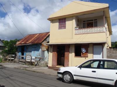
After lunch, Barb and Chuck gave us a tour of the town. Downtown is only a few blocks big. Just like on the main drag, the buildings farther back are mostly low bungalows and they range in maintenance from really nice to totally falling apart, with most in the weather beaten category. This gives you a sense of the range.
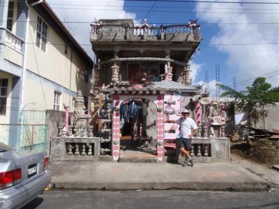
There is a house under construction that is fascinating. Barb and Chuck call it the “shell house” and when we saw it, we understood why. It is being decorated with sea life. There are lots and lots of beautiful shells, sea fans, and other items from the ocean. The décor is elaborate and impressive.
Then we saw the remains of the Catholic Church, which a couple blocks down the same street. It collapsed in an earthquake a couple years ago. All that is left is the tile floor. Across the street is the Catholic school, which is, fortunately, in good shape. We stopped by a bakery near there to get some bread. We saw what looked like muffins on display. We asked what flavor they were and were told plain. We got some. They turned out to be unfrosted cupcakes, but they weren’t plain. It was a spice cake with just the right blend of seasonings to make them to die for good. There was definitely a lot of nutmeg in there, but we are not sure what other spices are.
After our tour of town, we headed back to Kosmos for the rest of the day.