Friday, October 31 — This morning it felt like 38 degrees with wind chill factor. Christi had a hard time dragging herself outside to watch the sunrise. Because of the cold, she didn’t stay outside long, but she was glad she at least got to enjoy a few minutes of the lovely dawn, Here were a couple shots:
We were pleased to report that this morning, the flooding was gone and all was back to normal in the marina. While Christi and Keith did school, Eric cleaned the sea strainers. There was lots of mud in them and two live fish! One fish was long and skinny. He thought it looked like a snake and wondered if it was an eel.
continued… Three weeks after the battle ended, Gettysburg attorney David Willis wrote to the Pennsylvania governor and proposed a new cemetery location in Gettysburg where the soldiers in the temporary graves could be properly buried. Wills got the approval from the governor and purchased the 17-acres of land. He hired a landscape architect, who designed the cemetery as a semi-circle, with soldiers of each state buried together in distinct sections.
Moving the bodies from the temporary graves to the cemetery sounded like it was a tough job. Wills paid contractors $1.59 per body moved. 3,555 bodies were moved within two years. It sounds like they were diligent to make sure all the Union soldiers bodies were moved… and it sounds like many Confederate soldiers bodies were overlooked for a decade. After the overlooked bodies were finally exhumed, they weren’t buried at the cemetery in Gettysburg — instead, they were shipped south.
continued… The attack on one side of the line began at 1530, the other at 1600. At 1800, fighting began at a third location. The fighting continued until nearly midnight, with 19,000 casualties in total. The signs described how copious amounts of dead bodies were strewn over the landscape and the earth was red, soaked with blood. The Confederates had again performed slightly better, but the Union had done a good job of keeping most of their ground.
Per one sign, Union commanders agreed to stay put on the high ground and maintain a defensive strategy. Per another sign, the Union army attacked the Confederates at dawn on July 3 in one spot and fought for seven hours.
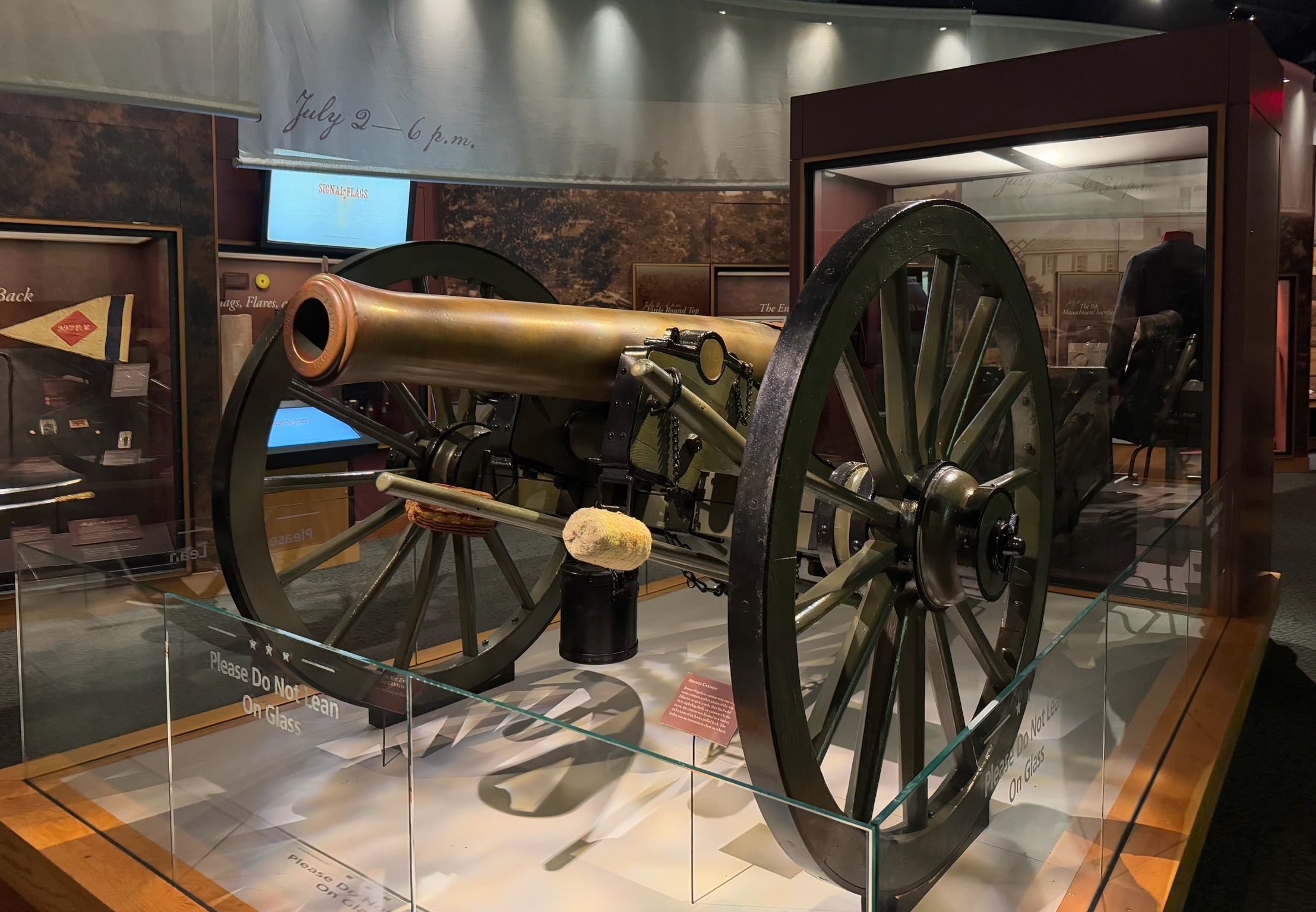
It sounded like once the fighting ended in that spot, General Lee decided to attack the center of the Union line. James Longstreet, who was assigned to lead the charge, was dubious that the Confederates could win, but followed orders. That assault began at 1300, with 160 cannons firing on the Union. Nearly 100 Union cannons fired back. Some of the gunners bled from both ears from the concussion. At 1500, in 90-degree Fahrenheit (32-degrees celsius) heat, what is now referred to as Pickett’s Charge commenced. 12,000 Confederate soldiers came out of hiding in the woods, formed a nearly one-mile wide line, and marched towards the Union lines. They were shot at as they marched, and men were continuously falling. With each fall, the men would “close ranks”, meaning the men still marching would move closer together to fill the gaps left by the fallen soldiers. There were “stout rail fences” in between the Confederate and Union soldiers that “proved to be a deadly obstacle.” It took the Confederates about a half-hour to reach the Union line. They briefly broke through the line, but quickly retreated. The Union soldiers cheered at the retreat. Nearly half the Confederate soldiers were killed, wounded or captured.
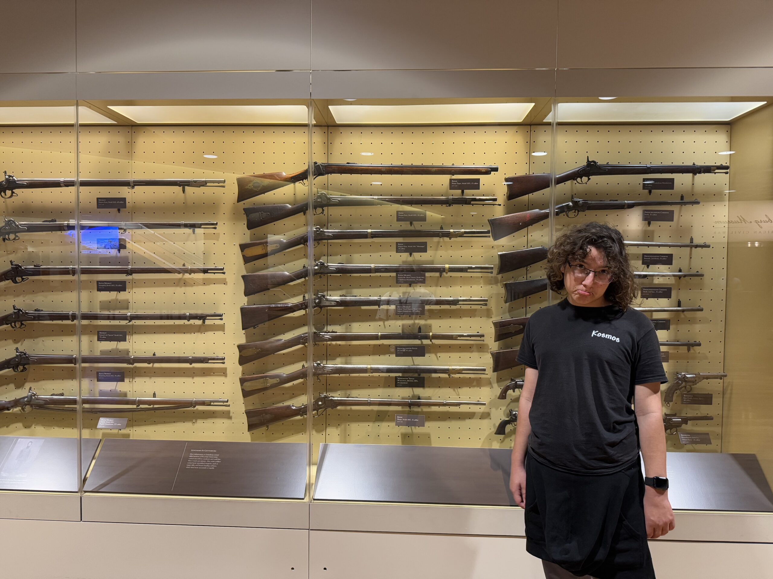
continued… At this point, the museum focused on the three branches of the Army — calvary, artillery and infantry — and the logistics involved in moving the army for battles.
There was a lot of information about the specific weapons each of the different branches used and why those were chosen for that branch.
The infantry’s job was to take and hold ground — essentially to run into the enemy lines for direct combat to physically push them backwards and thus win that ground. The two sides fired on one another at point blank range and often engaged in hand to hand combat. The artillery units supported the infantry units in attack and defense and tried to destroy the enemy’s artillery — they were the ones who manned the cannons, which were fired from a distance. The calvary were on horses and primarily acted as scouts and screeners, finding the enemy, reporting their locations, and preventing the other side’s Calvary from doing the same. Infrequently, the calvary raided supply lines, cut communications, burned bridges and railroads, and charged full tilt into the enemy’s calvary.
continued… By February 1861, six more states had seceded: Mississippi, Florida, Alabama, Georgia, Louisiana, and Texas. In March 1861, still using the model set by the founding father’s during the Revolution, they ratified a new Constitution for the Confederate States of America and elected Jefferson Davis as their first president. Like all other governments, they issued currency, bonds and postage stamps.
As we’d learned at the USS Constellation, about 1/4 of the Union navy’s fleet resigned to join the Confederacy, leaving the navy woefully understaffed. We didn’t see a sign that gave statistics of exactly how many military personnel joined the Confederacy in total; the sign we saw said “…hundreds of …US Officers resigned their commissions to join the Confederacy…” One of them was Robert E. Lee, who was recognized as a top military leader who had served with distinction in the Mexican-American War.
The Civil War began about 0430 on April 12, 1861, when Confederate batteries opened on Fort Sumpter. The fort guarded the entrance to Charleston Harbor in South Carolina, making it a strategic location. Both the new Confederate States of America and the United States of America claimed the fort. By the time the battle started, negotiations had already dragged on for months. For the Union, abandoning Sumter would be an admission of weakness, but they knew if they reinforced it, they’d risk war. Lincoln decided to resupply the fort without bringing in any more weapons or troops. The new Confederacy viewed even this as too much, and President Davis gave the order to take the fort. The battle lasted for 34 hours and the Confederates won.
In April and May 1861, Virginia, Arkansas, Tennessee and North Carolina seceded from the US and joined the new Confederate States of America. People in Missouri, Kentucky and Maryland tried to get their states to secede, but failed to rally enough support.
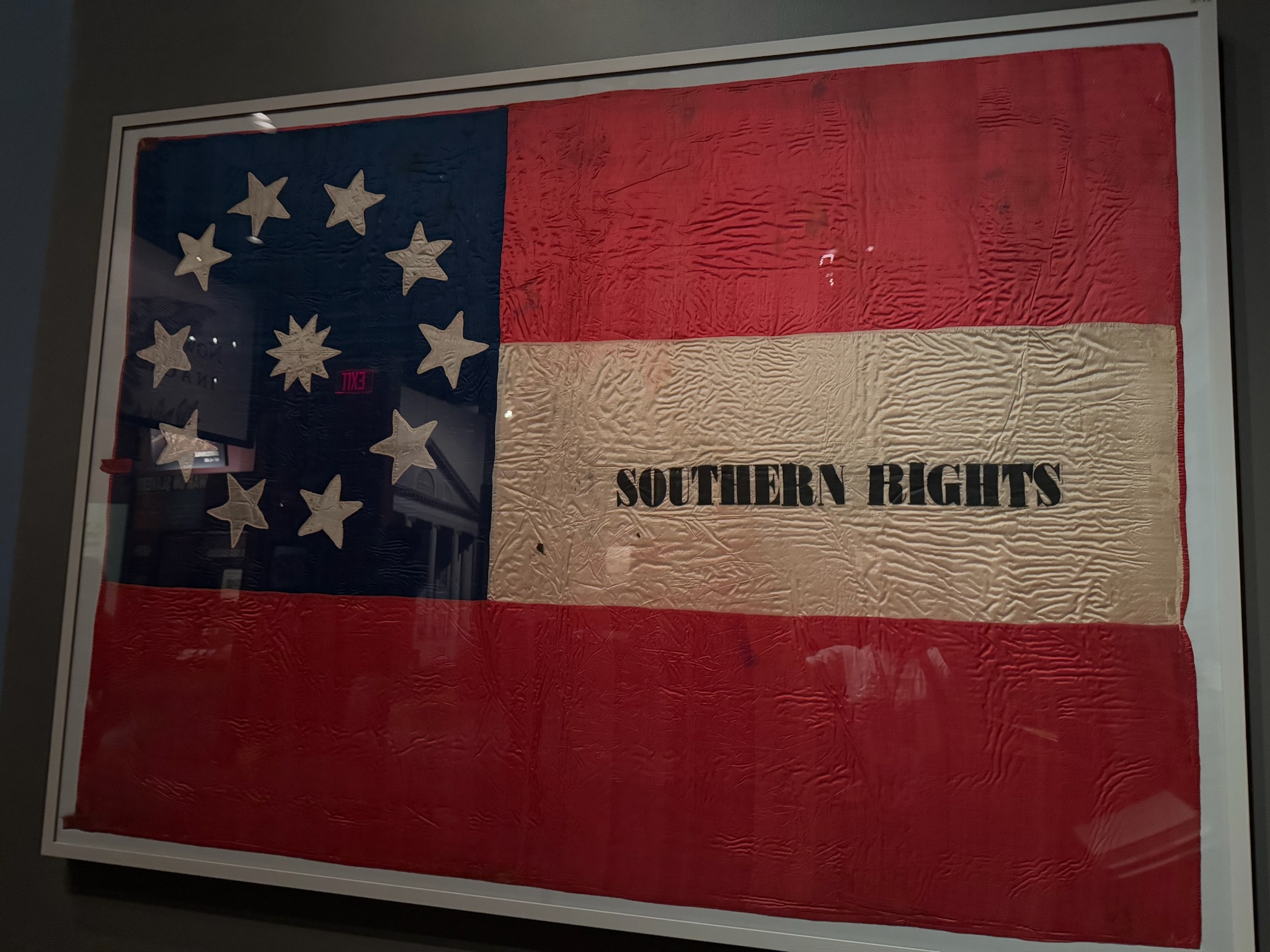
This was the original Confederate States of America flag, adopted in 1861.Continue reading →