Diving Hilma Hooker

We plan to leave tomorrow for a 5 day passage. The grocery stores in Bonaire, like most places in the world, have a poor selection of frozen foods, so Christi needed to make some freezer meals. She spent the morning cooking. She already had made some freezer meals over the last few days, but this morning was a flat out effort to make a lot of stuff at once. We also made a trip into town to check out with the officials. The check out fee was $10.00.

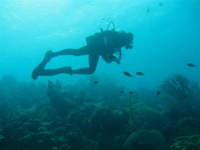
In the afternoon, we went on one last dive with Mike from Arielle. We went to the wreck that the dive center had recommended yesterday, Hilma Hooker. The rumor that we heard is that the boat had to make an emergency stop in Bonaire because it was taking on water. The authorities found lots of marijuana on board, so the Bonairian authorities seized the vessel. It was in bad shape and needed to be constantly pumped to keep it afloat. The authorities decided the best thing to do with the boat was tow it to a sandy site and let it sink, making an artificial reef. The facts that we know are it was deliberately sunk in 1984 on a carefully chosen sandy spot located between two reefs. The boat lies on its side. The highest point of the ship is 60 feet under the water and the lowest point, the tip of the mast is in 99 feet of water.

The site is close to the salt mountains. We tied to the mooring and jumped in. The reef around the mooring area is pretty, but we didn’t bother to stop and look around. Because this is such a deep dive, the plan was to descend quickly to the lowest point of the wreck, then slowly work our way back up. We’d enjoy the reef here at the end of the dive.

We all agreed that as we proceeded west it looked like the water ahead was murky with poor visibility. Each of us was wondering when this wreck would appear. Then it suddenly dawned on us that the dark area ahead WAS the hull, and in looking more carefully, we could see the line of the hull. We were staring at the bottom of the boat. Mike and Eric stuck to the plan, staying close to the floor. Christi was having trouble equalizing and was swimming along above them. She did eventually make it down to the hull, but never got down to the lowest portions of it.

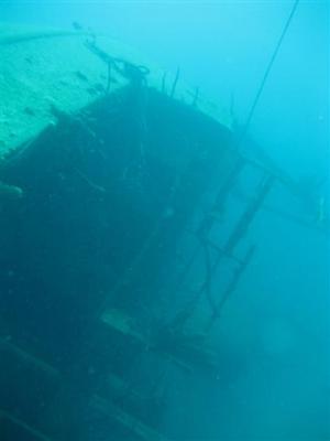
We swam around the aft end of the boat to get a look at the topside. It looks creepy and haunted in the darkish water, as most sunken ships tend to look. The hull is still pretty well intact.
img_3488-small.jpg

The guys swam down to the mast and crow’s nest to check them out, but Christi couldn’t get down that low. The guys ascended to Continue reading

Diving Class Bottom

We again talked Jack and Mike into taking us diving. This time we headed north to a wreck dive we had heard about. The wreck is in front of a dive center, and there was no mooring to tie to. We asked the dive center if we could tie up to their pier. They told us it isn’t a very good dive and suggested we go to a better wreck dive down south. Apparently, it was just a small wooden boat that is almost totally disintegrated now.

We motored over to the exact spot that the dive guy said the wreck was located and Jack stuck his face in the water. He agreed it wasn’t worth exploring. Since we were already up north, we decided to go to a nearby site that sounded especially nice. It is called Class Bottom. We tied up to the buoy. There were a lot of fish right under dinghy, especially sergeant fish and the little gray chromium fish. A good sign indeed!

Jack snorkeled around the general area, but once again, said it really wasn’t a very good snorkeling spot. Mike, Christi and Eric dove it and thought it was a great dive site. After we jumped in, we headed south to the next dive site marker, called Andrea I. The visibility here is the worst of all the sites we have been to in Bonaire, but it is still good. The visibility everywhere else has been phenomenal. There is very little trash around, and we expected a site farther away from town to be more pristine.

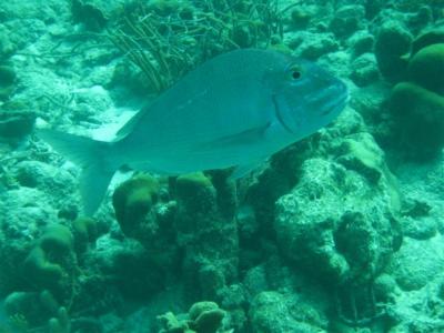
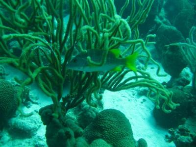
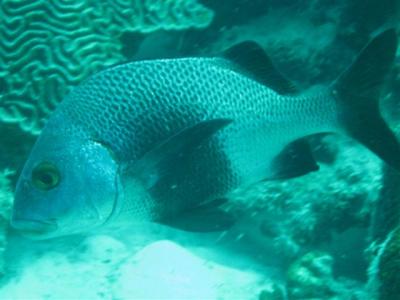
Once again, Mike brought his camera, so we can show you some of the fish we saw. The first is called a black margate. The second is called a jolthead porgy. The third is called a schoolmaster. The schoolmaster is in a giant sea rod soft coral. The three mounds in the foreground (left, right, middle) are great star hard coral, which Christi thinks looks like cells.

black-margate-small.jpg

jolthead-porgy-small.jpg

schoolmaster-giant-sea-rod-soft-coral-small.jpg

This spot has the best Continue reading

Diving Sharon’s Serenity on Klein Bonaire

We had managed to sweet talk two of the crew on Arielle into taking us diving on Klein Bonaire, which is supposed to have the best diving of all in Bonaire. We have been wanting to go, but the wind and swell are way too strong for our little 2 horsepower dinghy motor to handle. First thing this morning, they picked us up in their powerful rib and we set off. It was actually a fairly long (and bumpy) ride. We went to a site on the west side of the little island called Sharon’s Serenity. One of the crew Mike, was diving, the other, Jack, was snorkeling.

Sadly, Jack said that it isn’t a very good snorkeling site. In all honesty, while Bonaire may be a diver’s paradise, it isn’t a great destination for snorkelers. The reefs aren’t really shallow enough for snorkeling. However, the dive was excellent. We are pleased to report that Mike has a dive camera and that he managed to get some phenomenal photos. The following pictures are all compliments of him.

The first shot is of Christi shortly after we descended, higher up on the reef. We like this picture because you can see the little gray chromium fish that are everywhere on Bonaire dives, and you get a good idea of what the landscape of the reef is like. Note the neat soft corals to the right. They really do look like they could be terrestrial plants.

chromis-corals-small.jpg

As we were making our way down, we had a huge school of Continue reading

Touring the Northeast Part of Bonaire

Yesterday we had rented the car at 0800, but the car wasn’t actually due back until 1300 today. Nice! We decided to make the most of our time and took a drive over to the northeast corner of the island, the only major area we haven’t explored yet. The map shows a paved road that went due east to the coast. There is a connecting dirt road that follows the coast around to the north of the island that meets up with the main highway near Rincon. There are four caves up there with Indian inscriptions that sound interesting to see.

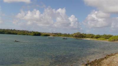
The road east is one we haven’t been on before. It is pretty much residential the whole way. We drove to the wetlands that open into the ocean and stopped. Hmmm”¦ the road north should be right here somewhere. It is a scenic location and we took some photos before getting back in the car.

dsc02270-small.jpg

dsc02275-small.jpg

On the next pass we saw the road. It had a sign for a ranch that made it look more like a driveway than a road, which is why we missed it in the first place. At first the road was fine. It was a little rutted out from when people drove in the mud, but it was a clearly marked road and it looked like it was regularly maintained. The farther north we went, the thinner the vegetation got. The trees slowly disappeared, replaced with low growing scrubby brush. The big bushes became fewer in between. It was really starting to Continue reading

Land Sailing, Windsurfing and the New “Welcoming Committee”

Yesterday was another errand day. First thing, we were back on the camera hunt. We heard about a place at the south end of town that might have one. We walked down there, but still no luck. Every place we have been to sells regular cameras with dive housings, not water resistant cameras. We understand why. They are afraid that someone will take a camera safe for 3 feet into 60 feet of water, then demand a refund. Anyway, we ran a few other errands, including going over to Harbor Marina to pay for the mooring and drop off one of our propane tanks to be filled.

As we were heading back to Kosmos in the dinghy, we saw a sail boat coming into the mooring area. It was about to Continue reading