Wednesday, March 12, 2025 — We were up again early to get the boat ready to go to sea. A storm was coming in the next few days. As much as we liked this place, we’d had to make a decision between staying here longer than planned or leaving sooner than planned. We opted for sooner. We picked an anchorage ten hours away so we could do a day run.
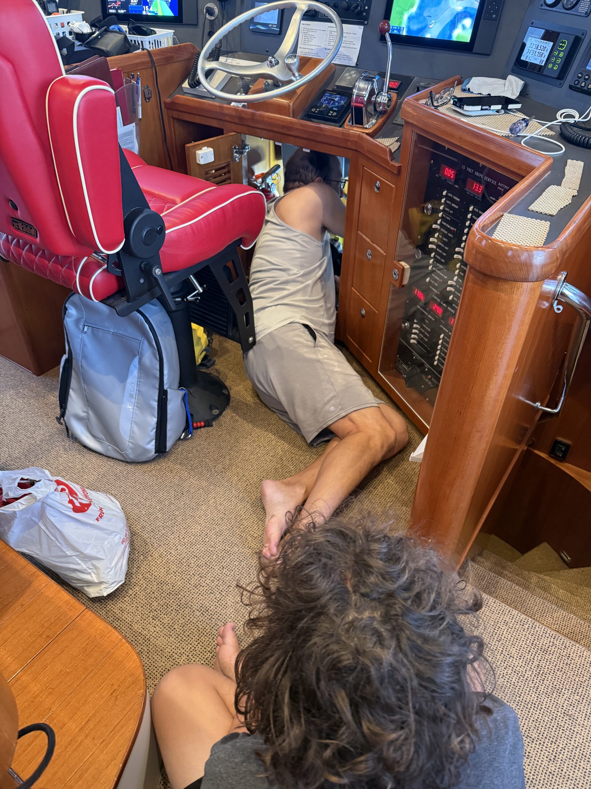
We quickly got the dinghy up and all the loose things stowed. As soon as dawn broke (shortly before 0700), Eric turned on the engine. The stabilizers didn’t turn on. Eric troubleshooted and determined that the servo controller (main computer) was getting power.
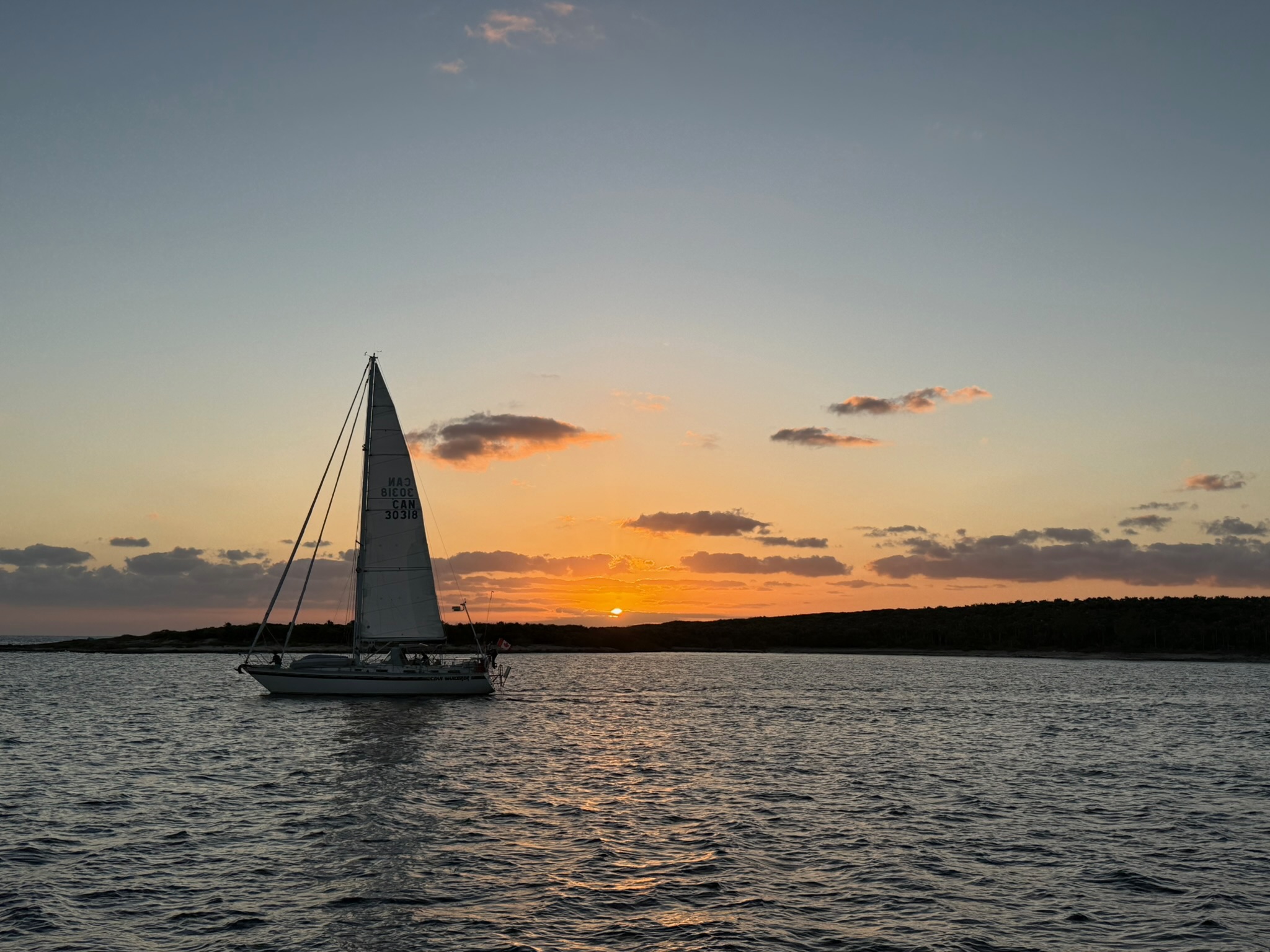
Our new friends also decided to move on for the storm. Here they were leaving the anchorage as the sun rose.
Tuesday, February 25, continued… After bypassing the battery protect device, and having Zeus set to 60% max load (~100 amps at cruising RPM), it was time to do some testing. First, Eric ensured switching to emergency power would work. He turned off the house bank via the BMS (simulating what had happened earlier), and then initiated emergency power by paralleling in another battery bank. It worked. Then Eric simulated being on a passage. He turned the main engine on, revved up to 1750 RPMs, and had all underway systems on. He watched the power readings like a hawk. This is where it got a bit weird. Every 400 seconds the Zeus restarted itself. Charging went to zero; but it had restart delay, so it took about 30 seconds to start charging again.
In general, we use about 60 amps underway, and this was actually enough charging for us to do the passage. However, watching the Zeus reset over and over made Eric nervous. He ran the engine for almost two hours, checking and watching. Eric had to made a decision: try to make it to Jamaica with a questionable alternator regulator, or re-check-in to Panama and try to troubleshoot more. Since the weather windows here were few and far between, he did not want to give up this window.
Now that we were certain that emergency power via paralleling another battery bank, we knew we could utilize the generator and the secondary alternator to charge the batteries. If there was a problem with the Zeus again, Eric would switch to emergency power, restart the LiFePo battery system, and run the generator to continue operating Kosmos via the LiFePo battery bank. He wanted to keep the secondary alternator in reserve and the other battery banks in reserve, as well. He also wired the ignition trigger voltage to a breaker in the pilot house, so if things started to go awry with Zeus, he could shut it down easily.
Keith and Christi helped with the testing/rewiring. Once Eric was done, Keith did archery with his friends. We had dinner in the marina restaurant.
On Wednesday, we didn’t need to wake up until 0500 to do the last minute things before going to sea since Kosmos was still mostly ready to go. Eric was feeling confident that that if there was another issue with the Zeus, he could turn it off via the switch that he’d wired up yesterday.
We untied at about 0600. This morning was much gloomier than yesterday, which felt ominous. We passed through the channel from the marina into the bay at low RPM’s, just as we had yesterday. When we were far enough into the bay that we felt like we were safe from any potential obstacles, Eric revved up the engine. All worked fine.
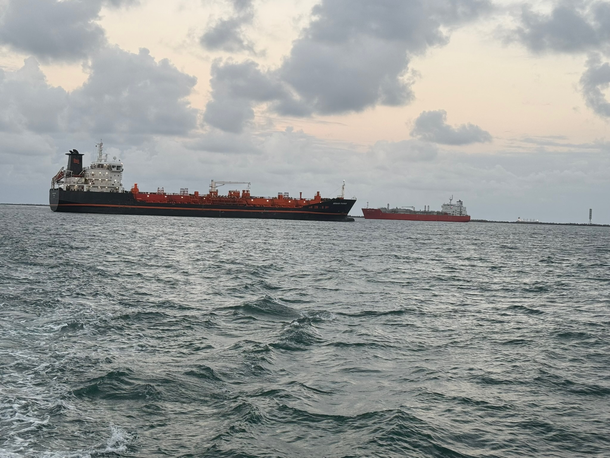
We exited Limon Bay via the east entrance. The big ships only use the west entrance, so we’d anticipated less traffic. Here were two ships passing in the west entrance.
Note: Christi normally writes the blog posts, however, since this is a boat technical post, Eric has authored this one.
Tuesday, February 25: We rolled out of bed at 0400 and did all the last minute things we always do before going to sea. Our first inkling that something could be wrong came at about 0530, when I turned on the main engine to warm it up. Before we get into the details, here is some important background information:
While underway, electricity to charge the batteries for Kosmos is made from an alternator on the main engine. It is an important system, and having electricity from the main engine allows us to run all the boats systems without running the generator. While underway, the boat uses quite a bit of electricity for air circulation, navigation/radar, and all the usual loads (refrigeration, freezer, lights, Internet etc.).
The main engine alternator is externally regulated by a product from ARCO called Zeus. External regulation is a general practice for interfacing with Lithium Iron Phosphate (LiFePo) batteries, which was part of the upgrades made to Kosmos after we got back from the Sea of Cortez. Zeus has an app and can connect via Bluetooth for configuration and monitoring. Mainly, it can reduce the load on the alternator ensuring it does not overheat. The Zeus box has several sensor wires for temperature, RPM, voltage, ignition, regulator control, etc.
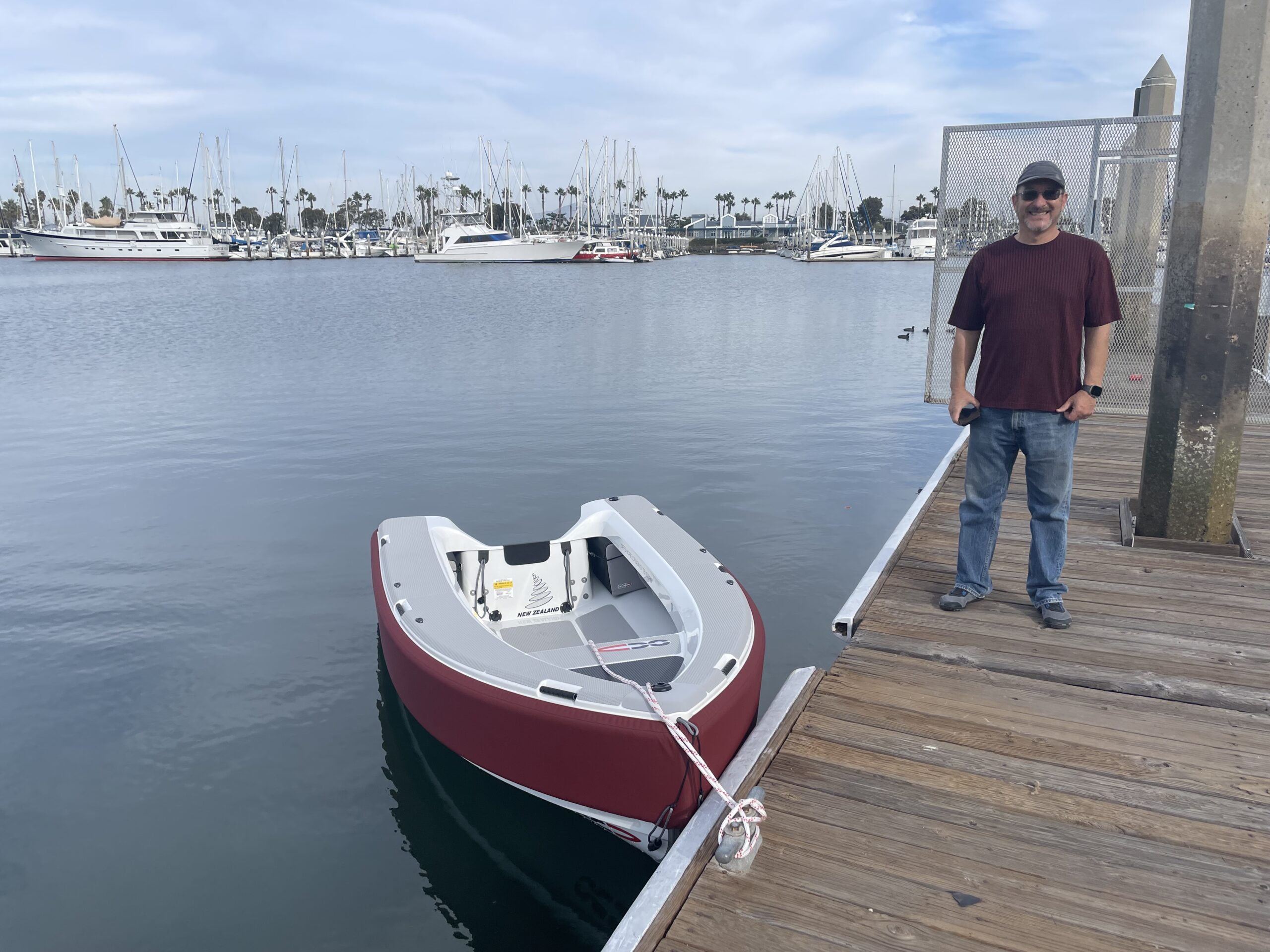
Wednesday, December 11, 2024 — Before we get into the day, we want to give a couple of quick backgrounds. Our beloved Gig Harbor hard sailing/rowing dinghy, Kosmopolitan, which circumnavigated the globe with us, was seriously damaged while we were in Baja. We managed to keep her floating with duct tape until we got back to San Diego. Upon return to San Diego, we replaced her with an OC Tender, which is also named Kosmopolitan. Here’s a photo of our new dinghy taken in San Diego.
When we were in the hurricane in Baja, the boat next to us in the storm was named Lusty. The people aboard Lusty were named Karen and Max, and they may be the funnest people we’ve ever met. We had an incredible time in the Bahia de Los Angeles area, largely because Max and Karen arranged a party every night — and Karen would cater it with incredible food. Christi was amazed at what Karen could make aboard a tiny boat kitchen.
On to our day… In the morning, Eric washed the boat, then walked over to the Port Captain’s office to check in. Meanwhile, Christi and Keith worked on school and did some cleaning inside.
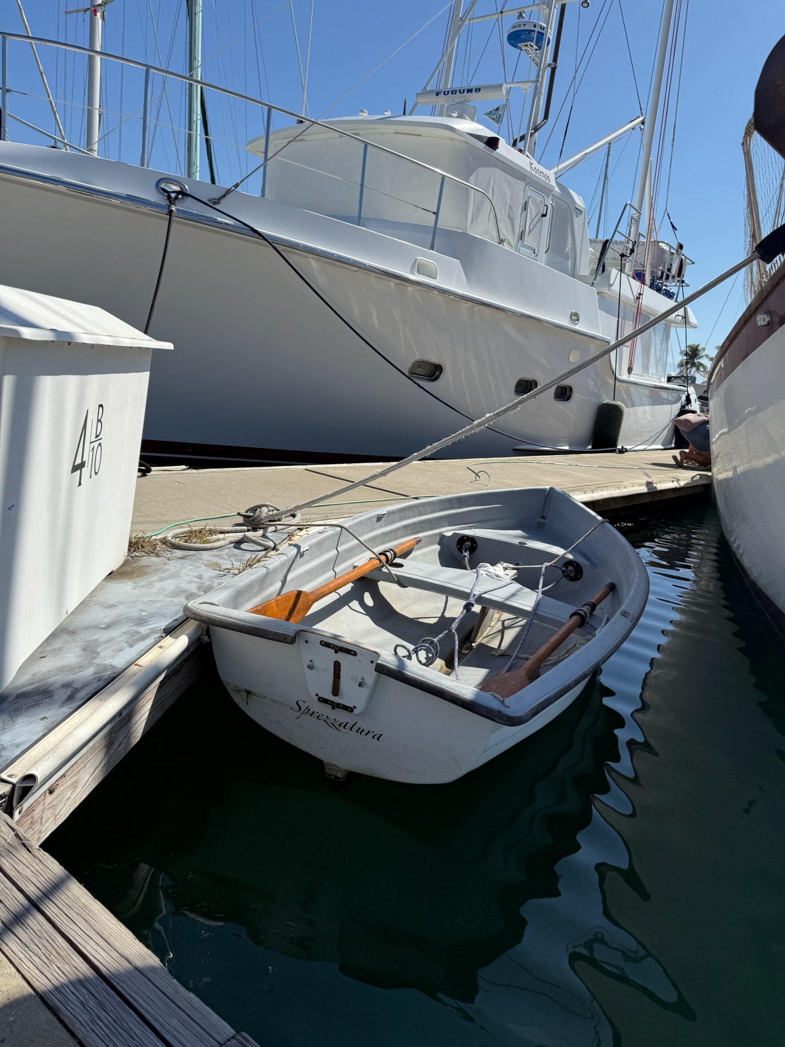
As we were leaving to go to lunch, we bumped into our neighbors and noticed they had a dinghy identical to the original Kosmopolitan. Then we noticed the name on the back was Sprezzatura, and asked if they had gotten it from our friend on the Nordhavn 40 named Sprezzatura. They confirmed it was the same dinghy, though it had changed hands a couple of times between our friend and our new neighbors. What a small world!
Our destination for lunch was a restaurant called El Ring, which was around the corner from Ballena Blanca. We noticed that the restaurant on the corner was named Lusty on Land. We knew it had to be Max and Karen’s. Especially when we saw they didn’t open until 1600 and had music every night.
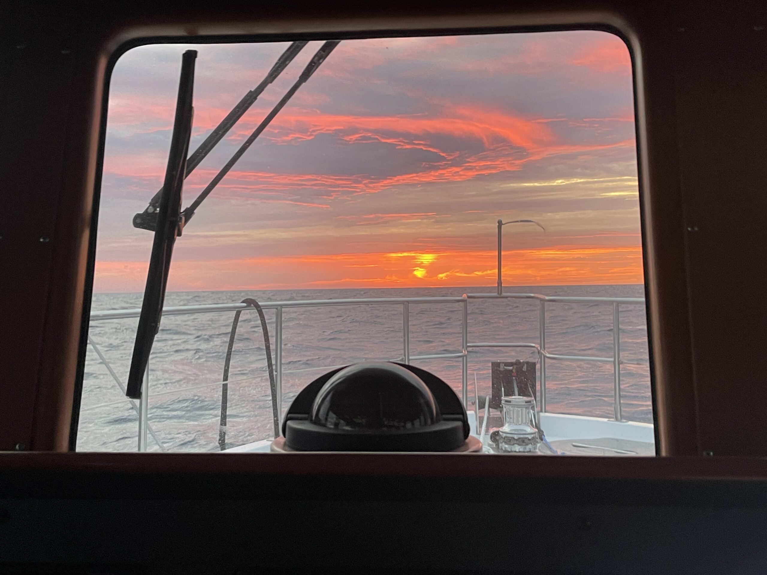
Tuesday, December 10 – Dawn on Monday was ominous, with a red glow behind deep gray clouds.
We’d changed course, so now the swell was coming from the behind us and the wind chop from our port side. The swell was large and created a lot of motion, but the intervals were far enough apart that it wasn’t terrible. The wind chop, on the other hand, was big: 3 – 5 feet of breaking whitecaps on our beam. Every once in a while, a wave would hit the pilot house windows. The combination of waves from two directions made it uncomfortable, though not terrible. We definitely needed to hold on tight when we walked around the boat. Sea conditions more or less stayed the same all day.